

Camino Real de la Frontera
A cycling route starting in Santiago, Santiago Metropolitan, Chile.
Overview
About this route
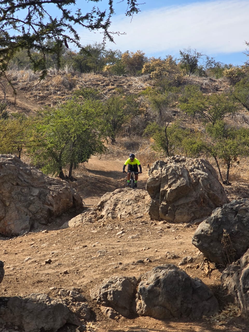
Salida desde Santiago a las 11am. A pesar de que era Enero había mucho para salir de Santiago. Elegí el Camino Real de la Fronetra como alternativa a la ruta Panamericana 5. El camino es bastante accesible wn tema de terreno. Sin embargo, después de pasar La Turbina hay un cerro para ascender. Una vez pasado ese cerro el camino hacia Rancagua es muy llevadero
- -:--
- Duration
- 94.6 km
- Distance
- 409 m
- Ascent
- 450 m
- Descent
- ---
- Avg. speed
- ---
- Max. altitude

Continue with Bikemap
Use, edit, or download this cycling route
You would like to ride Camino Real de la Frontera or customize it for your own trip? Here is what you can do with this Bikemap route:
Free features
- Save this route as favorite or in collections
- Copy & plan your own version of this route
- Split it into stages to create a multi-day tour
- Sync your route with Garmin or Wahoo
Premium features
Free trial for 3 days, or one-time payment. More about Bikemap Premium.
- Navigate this route on iOS & Android
- Export a GPX / KML file of this route
- Create your custom printout (try it for free)
- Download this route for offline navigation
Discover more Premium features.
Get Bikemap PremiumFrom our community
Other popular routes starting in Santiago
 Tarapacá, Santiago a Serrano, Santiago
- Distance
- 16.4 km
- Ascent
- 174 m
- Descent
- 123 m
- Location
- Santiago, Santiago Metropolitan, Chile
 sancristobalstartlap
- Distance
- 2.5 km
- Ascent
- 80 m
- Descent
- 80 m
- Location
- Santiago, Santiago Metropolitan, Chile
 Parque Quebrada de Macul
- Distance
- 30.7 km
- Ascent
- 471 m
- Descent
- 483 m
- Location
- Santiago, Santiago Metropolitan, Chile
 salida sabado 21 agosto
- Distance
- 45.6 km
- Ascent
- 581 m
- Descent
- 581 m
- Location
- Santiago, Santiago Metropolitan, Chile
 Plaza Italia, Las Vizcachas, Las Melosas y vuelta
- Distance
- 191.4 km
- Ascent
- 1,134 m
- Descent
- 1,134 m
- Location
- Santiago, Santiago Metropolitan, Chile
 Paseo fácil
- Distance
- 39.5 km
- Ascent
- 504 m
- Descent
- 516 m
- Location
- Santiago, Santiago Metropolitan, Chile
 De Avenida El Cerro 1877, Providencia a Avenida El Cerro 1877, Providencia
- Distance
- 13.7 km
- Ascent
- 876 m
- Descent
- 873 m
- Location
- Santiago, Santiago Metropolitan, Chile
 1- Ruta Familiar: Hotel Sheraton to Costanera Center
- Distance
- 1.5 km
- Ascent
- 9 m
- Descent
- 8 m
- Location
- Santiago, Santiago Metropolitan, Chile
Open it in the app