

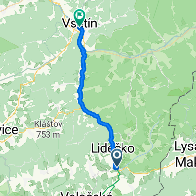
horní lideč 2
A cycling route starting in Horní Lideč, Zlín, Czechia.
Overview
About this route
časovka
- -:--
- Duration
- 31.3 km
- Distance
- 424 m
- Ascent
- 425 m
- Descent
- ---
- Avg. speed
- ---
- Max. altitude
Route quality
Waytypes & surfaces along the route
Waytypes
Road
30.7 km
(98 %)
Quiet road
0.6 km
(2 %)
Surfaces
Paved
16.4 km
(52 %)
Asphalt
16.4 km
(52 %)
Undefined
14.9 km
(48 %)
Continue with Bikemap
Use, edit, or download this cycling route
You would like to ride horní lideč 2 or customize it for your own trip? Here is what you can do with this Bikemap route:
Free features
- Save this route as favorite or in collections
- Copy & plan your own version of this route
- Sync your route with Garmin or Wahoo
Premium features
Free trial for 3 days, or one-time payment. More about Bikemap Premium.
- Navigate this route on iOS & Android
- Export a GPX / KML file of this route
- Create your custom printout (try it for free)
- Download this route for offline navigation
Discover more Premium features.
Get Bikemap PremiumFrom our community
Other popular routes starting in Horní Lideč
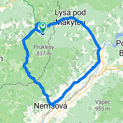
 Kolecko po valassku
- Distance
- 51.4 km
- Ascent
- 868 m
- Descent
- 908 m
- Location
- Horní Lideč, Zlín, Czechia
 Naučná stezka Vařákovy paseky
- Distance
- 12.3 km
- Ascent
- 374 m
- Descent
- 387 m
- Location
- Horní Lideč, Zlín, Czechia
 Bytca -Horni Lidec-Pulcin -Kohutka-Fram-Melocik-Bytca
- Distance
- 66.8 km
- Ascent
- 932 m
- Descent
- 1,091 m
- Location
- Horní Lideč, Zlín, Czechia
 Študlov-Vsetín-Vizovice-Študlov
- Distance
- 71.7 km
- Ascent
- 543 m
- Descent
- 543 m
- Location
- Horní Lideč, Zlín, Czechia
 Přejezd slovenských hor 2013
- Distance
- 423.1 km
- Ascent
- 2,506 m
- Descent
- 2,763 m
- Location
- Horní Lideč, Zlín, Czechia
 Lačnov-Kletné
- Distance
- 109.7 km
- Ascent
- 1,043 m
- Descent
- 1,254 m
- Location
- Horní Lideč, Zlín, Czechia
 Horní Lideč, Horní Lideč až Žerotínova, Vsetín
- Distance
- 22.8 km
- Ascent
- 88 m
- Descent
- 202 m
- Location
- Horní Lideč, Zlín, Czechia
 Študlov-Půchov-Nemšová-Študlov
- Distance
- 84.7 km
- Ascent
- 451 m
- Descent
- 451 m
- Location
- Horní Lideč, Zlín, Czechia
Open it in the app