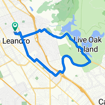
The Grand Cru: Tour de Biere 2013
A cycling route starting in San Leandro, California, United States of America.
Overview
About this route
see www.thegrandcru.org/tdb2013 for details
(cloned from route 1975942)
- -:--
- Duration
- 31.4 km
- Distance
- 30 m
- Ascent
- 30 m
- Descent
- ---
- Avg. speed
- ---
- Avg. speed
Route quality
Waytypes & surfaces along the route
Waytypes
Busy road
10.3 km
(33 %)
Quiet road
8.3 km
(27 %)
Surfaces
Paved
18.7 km
(59 %)
Unpaved
0.1 km
(<1 %)
Asphalt
14.8 km
(47 %)
Paved (undefined)
3.8 km
(12 %)
Route highlights
Points of interest along the route
Point of interest after 9.4 km
Spunkmeyer field. Regroup here. And bathroom?
Point of interest after 21.4 km
Linden Street
Point of interest after 30.7 km
Trumer
Continue with Bikemap
Use, edit, or download this cycling route
You would like to ride The Grand Cru: Tour de Biere 2013 or customize it for your own trip? Here is what you can do with this Bikemap route:
Free features
- Save this route as favorite or in collections
- Copy & plan your own version of this route
- Sync your route with Garmin or Wahoo
Premium features
Free trial for 3 days, or one-time payment. More about Bikemap Premium.
- Navigate this route on iOS & Android
- Export a GPX / KML file of this route
- Create your custom printout (try it for free)
- Download this route for offline navigation
Discover more Premium features.
Get Bikemap PremiumFrom our community
Other popular routes starting in San Leandro
- Enhanced commute
- Distance
- 18 km
- Ascent
- 32 m
- Descent
- 29 m
- Location
- San Leandro, California, United States of America
- San Leandro - Lake Chabot - Palomares Road - Niles Canyon Circuit
- Distance
- 58.9 km
- Ascent
- 525 m
- Descent
- 525 m
- Location
- San Leandro, California, United States of America
- Lake Chabot Circuit
- Distance
- 12.8 km
- Ascent
- 237 m
- Descent
- 237 m
- Location
- San Leandro, California, United States of America
- Chabot Loop 1
- Distance
- 13 km
- Ascent
- 226 m
- Descent
- 227 m
- Location
- San Leandro, California, United States of America
- Chabot Lake-Redwood Road-Skyline Circuit
- Distance
- 42.4 km
- Ascent
- 578 m
- Descent
- 579 m
- Location
- San Leandro, California, United States of America
- San Leandro - Alameda Loop
- Distance
- 43 km
- Ascent
- 45 m
- Descent
- 48 m
- Location
- San Leandro, California, United States of America
- Davis Street 1919, San Leandro to Post Street 711, San Francisco
- Distance
- 36.8 km
- Ascent
- 145 m
- Descent
- 83 m
- Location
- San Leandro, California, United States of America
- Lake Chabot to CV BART via Loards
- Distance
- 9.6 km
- Ascent
- 148 m
- Descent
- 148 m
- Location
- San Leandro, California, United States of America
Open it in the app