

Enger-Lignano Sabbiadoro
- 1,181.8 km
- 13,410 m
- 13,504 m
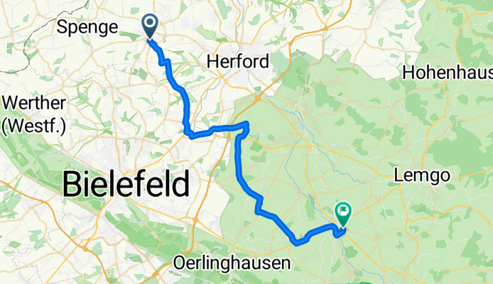
- Enger, North Rhine-Westphalia, Germany
A cycling route starting in Enger, North Rhine-Westphalia, Germany.
Overview
The route lies on secondary roads with good pavement for road cyclists or has acceptable cycle paths (with exceptions) along main roads. Without passing through the town centres of larger places like Herford or Bad Salzuflen, the traffic volume is comparatively low compared to the route through these towns. The frequent climbs are only slight and short.
Route quality
Road
16.1 km
47 %
Quiet road
8.5 km
25 %
Paved
30.4 km
(89 %)
Asphalt
30.4 km
89 %
Undefined
3.8 km
11 %
Continue with Bikemap
You would like to ride Enger - Brake - Lockhausen - Leopoldshöhe - Lage or customize it for your own trip? Here is what you can do with this Bikemap route:
Free trial for 3 days, or one-time payment. More about Bikemap Premium.
Discover more Premium features.
Get Bikemap PremiumFrom our community
Open it in the app


