

A bisserl Qual muß sein
A cycling route starting in Lauf an der Pegnitz, Bavaria, Germany.
Overview
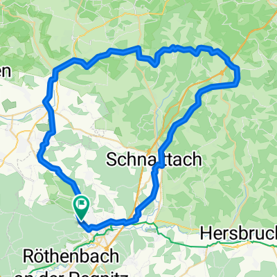
About this route
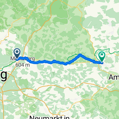
It's nicely flat up to Kirchensittenbach. The transition to Siegersdorf is tough! After the descent, a short climb towards Rothenberg. From Schnaittach through the forest to Dehnberg.
- -:--
- Duration
- 35.6 km
- Distance
- 413 m
- Ascent
- 410 m
- Descent
- ---
- Avg. speed
- ---
- Max. altitude

Route quality
Waytypes & surfaces along the route
Waytypes
Path
9.6 km
(27 %)
Quiet road
8.6 km
(24 %)
Surfaces
Paved
18.5 km
(52 %)
Unpaved
7.8 km
(22 %)
Asphalt
18.5 km
(52 %)
Gravel
6.1 km
(17 %)
Continue with Bikemap
Use, edit, or download this cycling route
You would like to ride A bisserl Qual muß sein or customize it for your own trip? Here is what you can do with this Bikemap route:
Free features
- Save this route as favorite or in collections
- Copy & plan your own version of this route
- Sync your route with Garmin or Wahoo
Premium features
Free trial for 3 days, or one-time payment. More about Bikemap Premium.
- Navigate this route on iOS & Android
- Export a GPX / KML file of this route
- Create your custom printout (try it for free)
- Download this route for offline navigation
Discover more Premium features.
Get Bikemap PremiumFrom our community
Other popular routes starting in Lauf an der Pegnitz
 Lauf-Ludwigshöhe-Lauf
- Distance
- 13.7 km
- Ascent
- 163 m
- Descent
- 163 m
- Location
- Lauf an der Pegnitz, Bavaria, Germany
 Lauf-Wildenfels 65km
- Distance
- 65.3 km
- Ascent
- 912 m
- Descent
- 909 m
- Location
- Lauf an der Pegnitz, Bavaria, Germany
 W - Klingender Wasserfall
- Distance
- 4.7 km
- Ascent
- 86 m
- Descent
- 84 m
- Location
- Lauf an der Pegnitz, Bavaria, Germany
 Lauf-Spieß 56km
- Distance
- 55.6 km
- Ascent
- 856 m
- Descent
- 856 m
- Location
- Lauf an der Pegnitz, Bavaria, Germany
 Fünf-Flüsse-Radweg 9/2025
- Distance
- 284.5 km
- Ascent
- 2,770 m
- Descent
- 2,825 m
- Location
- Lauf an der Pegnitz, Bavaria, Germany
 A bisserl Qual muß sein
- Distance
- 35.6 km
- Ascent
- 413 m
- Descent
- 410 m
- Location
- Lauf an der Pegnitz, Bavaria, Germany
 1. Tour Lauf Sulzbach- Rosenberger Straße
- Distance
- 41.4 km
- Ascent
- 504 m
- Descent
- 443 m
- Location
- Lauf an der Pegnitz, Bavaria, Germany
 Speikernrunde
- Distance
- 12.8 km
- Ascent
- 104 m
- Descent
- 104 m
- Location
- Lauf an der Pegnitz, Bavaria, Germany
Open it in the app