

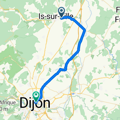
Sion - Roscoff du 10.04 au 21.04.2012
A cycling route starting in Marcilly-sur-Tille, Bourgogne-Franche-Comté, France.
Overview
About this route
4th stage on 13.04
Till Châtel - Châtillon sur Seine
- -:--
- Duration
- 73.7 km
- Distance
- 395 m
- Ascent
- 452 m
- Descent
- ---
- Avg. speed
- ---
- Max. altitude

Route quality
Waytypes & surfaces along the route
Waytypes
Road
7.4 km
(10 %)
Quiet road
0.7 km
(1 %)
Surfaces
Paved
31 km
(42 %)
Asphalt
31 km
(42 %)
Undefined
42.8 km
(58 %)
Continue with Bikemap
Use, edit, or download this cycling route
You would like to ride Sion - Roscoff du 10.04 au 21.04.2012 or customize it for your own trip? Here is what you can do with this Bikemap route:
Free features
- Save this route as favorite or in collections
- Copy & plan your own version of this route
- Sync your route with Garmin or Wahoo
Premium features
Free trial for 3 days, or one-time payment. More about Bikemap Premium.
- Navigate this route on iOS & Android
- Export a GPX / KML file of this route
- Create your custom printout (try it for free)
- Download this route for offline navigation
Discover more Premium features.
Get Bikemap PremiumFrom our community
Other popular routes starting in Marcilly-sur-Tille
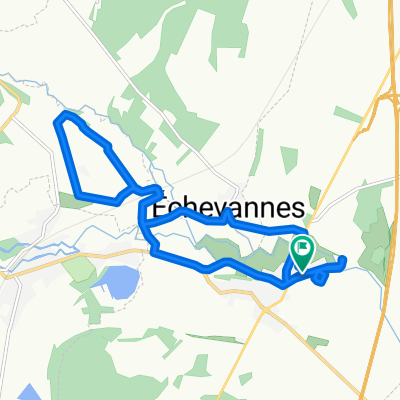
 Trier-Cluny, Etappe 8, Marcilly-s-Tille - Dijon
- Distance
- 32.3 km
- Ascent
- 91 m
- Descent
- 127 m
- Location
- Marcilly-sur-Tille, Bourgogne-Franche-Comté, France
 De 1 Impasse du Fourneau, Til-Châtel à 1 Impasse du Fourneau, Til-Châtel
- Distance
- 13.3 km
- Ascent
- 49 m
- Descent
- 19 m
- Location
- Marcilly-sur-Tille, Bourgogne-Franche-Comté, France
 De Impasse du Fourneau 1, Til-Châtel à Impasse du Fourneau 1, Til-Châtel
- Distance
- 9.8 km
- Ascent
- 176 m
- Descent
- 144 m
- Location
- Marcilly-sur-Tille, Bourgogne-Franche-Comté, France
 De Impasse du Fourneau 1, Til-Châtel à Impasse du Fourneau 1, Til-Châtel
- Distance
- 11 km
- Ascent
- 310 m
- Descent
- 271 m
- Location
- Marcilly-sur-Tille, Bourgogne-Franche-Comté, France
 De Impasse du Fourneau 1, Til-Châtel à Impasse du Fourneau 1, Til-Châtel
- Distance
- 10.9 km
- Ascent
- 235 m
- Descent
- 198 m
- Location
- Marcilly-sur-Tille, Bourgogne-Franche-Comté, France
 De Impasse du Fourneau 1, Til-Châtel à Impasse du Fourneau 1, Til-Châtel
- Distance
- 2.3 km
- Ascent
- 46 m
- Descent
- 54 m
- Location
- Marcilly-sur-Tille, Bourgogne-Franche-Comté, France
 De Impasse du Fourneau 1, Til-Châtel à Impasse du Fourneau 1, Til-Châtel
- Distance
- 9.8 km
- Ascent
- 220 m
- Descent
- 190 m
- Location
- Marcilly-sur-Tille, Bourgogne-Franche-Comté, France
 De 1 Impasse du Fourneau, Til-Châtel à 1 Impasse du Fourneau, Til-Châtel
- Distance
- 13.7 km
- Ascent
- 15 m
- Descent
- 16 m
- Location
- Marcilly-sur-Tille, Bourgogne-Franche-Comté, France
Open it in the app