

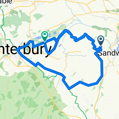
Preston - Stowting
A cycling route starting in Ash, England, United Kingdom.
Overview
About this route
Preston - Bridge - Stowting - Bridge - Aylesham - Woodnesborough - Preston
- -:--
- Duration
- 87 km
- Distance
- 386 m
- Ascent
- 386 m
- Descent
- ---
- Avg. speed
- ---
- Max. altitude
Route quality
Waytypes & surfaces along the route
Waytypes
Road
62.6 km
(72 %)
Quiet road
21.7 km
(25 %)
Undefined
2.6 km
(3 %)
Surfaces
Paved
37.4 km
(43 %)
Asphalt
37.4 km
(43 %)
Undefined
49.6 km
(57 %)
Continue with Bikemap
Use, edit, or download this cycling route
You would like to ride Preston - Stowting or customize it for your own trip? Here is what you can do with this Bikemap route:
Free features
- Save this route as favorite or in collections
- Copy & plan your own version of this route
- Split it into stages to create a multi-day tour
- Sync your route with Garmin or Wahoo
Premium features
Free trial for 3 days, or one-time payment. More about Bikemap Premium.
- Navigate this route on iOS & Android
- Export a GPX / KML file of this route
- Create your custom printout (try it for free)
- Download this route for offline navigation
Discover more Premium features.
Get Bikemap PremiumFrom our community
Other popular routes starting in Ash
 Coronavirus Cycle Canterbury-Dover
- Distance
- 72.8 km
- Ascent
- 262 m
- Descent
- 231 m
- Location
- Ash, England, United Kingdom
 Preston - Stowting
- Distance
- 87 km
- Ascent
- 386 m
- Descent
- 386 m
- Location
- Ash, England, United Kingdom
 Tuesday
- Distance
- 24.7 km
- Ascent
- 220 m
- Descent
- 216 m
- Location
- Ash, England, United Kingdom
 Easy ride in Canterbury
- Distance
- 7.2 km
- Ascent
- 36 m
- Descent
- 32 m
- Location
- Ash, England, United Kingdom
 PluckGutter2Canterbury
- Distance
- 18.8 km
- Ascent
- 70 m
- Descent
- 59 m
- Location
- Ash, England, United Kingdom
 Kent loop 3
- Distance
- 60.8 km
- Ascent
- 258 m
- Descent
- 258 m
- Location
- Ash, England, United Kingdom
 Chequer Lane 43, Ash to Chequer Lane 42, Ash
- Distance
- 27.9 km
- Ascent
- 97 m
- Descent
- 100 m
- Location
- Ash, England, United Kingdom
 Challnge 75
- Distance
- 118.8 km
- Ascent
- 523 m
- Descent
- 462 m
- Location
- Ash, England, United Kingdom
Open it in the app