

14 Ochutnávka Galmusu
A cycling route starting in Krompachy, Košice Region, Slovakia.
Overview
About this route
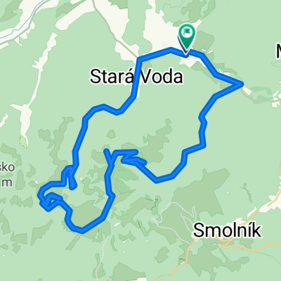
A pleasant, easy cycling route with one challenging ascent. It is set in a landscape and nature reserve area of great significance in the Volovské vrchy - Galmus. The cycling route starts and ends in front of the municipal office. We head east along the blue cycling route 2709. At the first intersection, we continue straight along with the green cycle route sign 5855. After a hundred meters of shared section at the road junction, we turn right and continue on the green cycle route 5855, steeply descending until we reach the Relaxsport center Poráč Park. Further down, we enjoy a gentle descent through the picturesque Poráč valley lined with the nature reserve Červené skály until we reach the junction of Ploštiny. We turn left and start climbing towards the junction of Galmus (3.5 km). We turn left again and remain true to the blue cycle route sign 2709 until we finish the loop. The remaining part of the loop is pleasantly comfortable for cyclists due to its easy topography.
- -:--
- Duration
- 20.2 km
- Distance
- 566 m
- Ascent
- 568 m
- Descent
- ---
- Avg. speed
- ---
- Max. altitude
Route quality
Waytypes & surfaces along the route
Waytypes
Track
19.2 km
(95 %)
Quiet road
1 km
(5 %)
Surfaces
Paved
1.2 km
(6 %)
Unpaved
13.9 km
(69 %)
Unpaved (undefined)
11.9 km
(59 %)
Paved (undefined)
1.2 km
(6 %)
Continue with Bikemap
Use, edit, or download this cycling route
You would like to ride 14 Ochutnávka Galmusu or customize it for your own trip? Here is what you can do with this Bikemap route:
Free features
- Save this route as favorite or in collections
- Copy & plan your own version of this route
- Sync your route with Garmin or Wahoo
Premium features
Free trial for 3 days, or one-time payment. More about Bikemap Premium.
- Navigate this route on iOS & Android
- Export a GPX / KML file of this route
- Create your custom printout (try it for free)
- Download this route for offline navigation
Discover more Premium features.
Get Bikemap PremiumFrom our community
Other popular routes starting in Krompachy
 Švedlár Závadka up and down 40 km
- Distance
- 39.7 km
- Ascent
- 1,327 m
- Descent
- 1,164 m
- Location
- Krompachy, Košice Region, Slovakia
 Around Knola
- Distance
- 84 km
- Ascent
- 1,613 m
- Descent
- 1,601 m
- Location
- Krompachy, Košice Region, Slovakia
 PO HREBENI
- Distance
- 24.9 km
- Ascent
- 481 m
- Descent
- 712 m
- Location
- Krompachy, Košice Region, Slovakia
 Švedlár Zlatý stôl kanal Švedlár
- Distance
- 46.9 km
- Ascent
- 1,049 m
- Descent
- 1,051 m
- Location
- Krompachy, Košice Region, Slovakia
 16 Za panoramatickými výhľadmi
- Distance
- 55.2 km
- Ascent
- 868 m
- Descent
- 861 m
- Location
- Krompachy, Košice Region, Slovakia
 Švedlar-Skalisko Zlatý stôl -tunel- Švedlar
- Distance
- 49.5 km
- Ascent
- 1,146 m
- Descent
- 1,143 m
- Location
- Krompachy, Košice Region, Slovakia
 Spišských 333EXTREME
- Distance
- 329.5 km
- Ascent
- 3,653 m
- Descent
- 3,653 m
- Location
- Krompachy, Košice Region, Slovakia
 Švedlar Genier Stara Voda strará štôlna Švedlar
- Distance
- 30.2 km
- Ascent
- 828 m
- Descent
- 766 m
- Location
- Krompachy, Košice Region, Slovakia
Open it in the app