

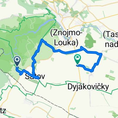
KUKA TOUR 2014 - 2. etapa
A cycling route starting in Šatov, South Moravian, Czechia.
Overview
About this route
Šátov - Šluk - Jaroslavice - Milovice
- -:--
- Duration
- 77 km
- Distance
- 222 m
- Ascent
- 306 m
- Descent
- ---
- Avg. speed
- ---
- Max. altitude

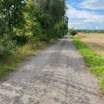
Route quality
Waytypes & surfaces along the route
Waytypes
Road
40.1 km
(52 %)
Quiet road
1.5 km
(2 %)
Undefined
35.4 km
(46 %)
Surfaces
Paved
40.1 km
(52 %)
Asphalt
40.1 km
(52 %)
Undefined
37 km
(48 %)
Continue with Bikemap
Use, edit, or download this cycling route
You would like to ride KUKA TOUR 2014 - 2. etapa or customize it for your own trip? Here is what you can do with this Bikemap route:
Free features
- Save this route as favorite or in collections
- Copy & plan your own version of this route
- Sync your route with Garmin or Wahoo
Premium features
Free trial for 3 days, or one-time payment. More about Bikemap Premium.
- Navigate this route on iOS & Android
- Export a GPX / KML file of this route
- Create your custom printout (try it for free)
- Download this route for offline navigation
Discover more Premium features.
Get Bikemap PremiumFrom our community
Other popular routes starting in Šatov
 KUKA TOUR 2014 - 2. etapa
- Distance
- 77 km
- Ascent
- 222 m
- Descent
- 306 m
- Location
- Šatov, South Moravian, Czechia
 Hardegg - Falkenstein (Kamp-Thaya-March 3)
- Distance
- 76.6 km
- Ascent
- 465 m
- Descent
- 469 m
- Location
- Šatov, South Moravian, Czechia
 ZWISCHEN HARDEGG UND ZNAIM
- Distance
- 63.8 km
- Ascent
- 891 m
- Descent
- 890 m
- Location
- Šatov, South Moravian, Czechia
 Eiserner Vorhang (overview): Satov - Gmünd
- Distance
- 165.4 km
- Ascent
- 1,091 m
- Descent
- 842 m
- Location
- Šatov, South Moravian, Czechia
 Hnanice - Cižov
- Distance
- 14.6 km
- Ascent
- 780 m
- Descent
- 638 m
- Location
- Šatov, South Moravian, Czechia
 Hotel Happy Star - Znojmo --HHS okruh
- Distance
- 38.7 km
- Ascent
- 445 m
- Descent
- 444 m
- Location
- Šatov, South Moravian, Czechia
 Znojmo Wine
- Distance
- 22.3 km
- Ascent
- 165 m
- Descent
- 246 m
- Location
- Šatov, South Moravian, Czechia
 KUKA TOUR 2014 - 1. etapa
- Distance
- 77.9 km
- Ascent
- 758 m
- Descent
- 753 m
- Location
- Šatov, South Moravian, Czechia
Open it in the app