

Sunnehörnli
A cycling route starting in Schwanden, Canton of Glarus, Switzerland.
Overview
About this route
Easy ski touring with a very beautiful natural experience. The lift takes you from 840 to 1230 meters above sea level. From there up to the Hörnli (2230 m) is a comfortable 1000-meter ascent. The descent through the Mühlebach valley is considered very good because it is shady.
- -:--
- Duration
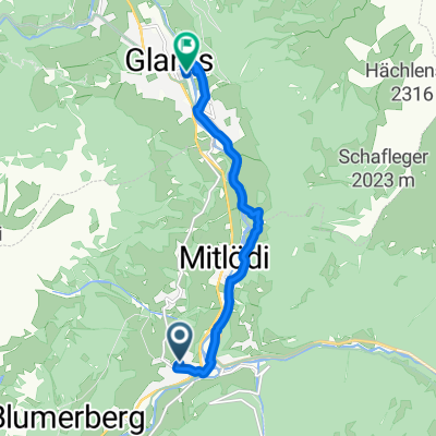
- 11.4 km
- Distance
- 1,372 m
- Ascent
- 1,408 m
- Descent
- ---
- Avg. speed
- ---
- Max. altitude

Continue with Bikemap
Use, edit, or download this cycling route
You would like to ride Sunnehörnli or customize it for your own trip? Here is what you can do with this Bikemap route:
Free features
- Save this route as favorite or in collections
- Copy & plan your own version of this route
- Sync your route with Garmin or Wahoo
Premium features
Free trial for 3 days, or one-time payment. More about Bikemap Premium.
- Navigate this route on iOS & Android
- Export a GPX / KML file of this route
- Create your custom printout (try it for free)
- Download this route for offline navigation
Discover more Premium features.
Get Bikemap PremiumFrom our community
Other popular routes starting in Schwanden
 Matt Riseten Alp
- Distance
- 9.5 km
- Ascent
- 1,093 m
- Descent
- 26 m
- Location
- Schwanden, Canton of Glarus, Switzerland
 Bikeroute 2 Schwanden - Achseli
- Distance
- 6 km
- Ascent
- 991 m
- Descent
- 131 m
- Location
- Schwanden, Canton of Glarus, Switzerland
 Sunnehörnli
- Distance
- 11.4 km
- Ascent
- 1,372 m
- Descent
- 1,408 m
- Location
- Schwanden, Canton of Glarus, Switzerland
 Fleggen 109, Glarus Süd nach Obbortstrasse 18, Linthal
- Distance
- 18 km
- Ascent
- 540 m
- Descent
- 210 m
- Location
- Schwanden, Canton of Glarus, Switzerland
 Klausenpass
- Distance
- 59.7 km
- Ascent
- 1,694 m
- Descent
- 2,248 m
- Location
- Schwanden, Canton of Glarus, Switzerland
 Recovered Route
- Distance
- 7.7 km
- Ascent
- 60 m
- Descent
- 155 m
- Location
- Schwanden, Canton of Glarus, Switzerland
 ÄcºŒ? nach ÄcºŒ?
- Distance
- 37.2 km
- Ascent
- 140 m
- Descent
- 270 m
- Location
- Schwanden, Canton of Glarus, Switzerland
 Engi - Skihuette - Lueser - Muelibach Oberstaffel - Engi - Elm - Schiessplatz - Engi @ 19.07.2020
- Distance
- 50.1 km
- Ascent
- 2,131 m
- Descent
- 2,130 m
- Location
- Schwanden, Canton of Glarus, Switzerland
Open it in the app