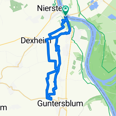
- 5.8 km
- 0 m
- 4 m
- Nierstein, Rhineland-Palatinate, Germany
Nierstein-Mainz-Bingen
A cycling route starting in Nierstein, Rhineland-Palatinate, Germany.
Overview
About this route
Predominantly asphalt, although partially very poor in the Mainz metropolitan area. The urban area of Mainz experiences heavy traffic, but there is a separate bike path. The signage for the Rhine path within the town is very inadequate, especially around the harbor. From Mainz towards Bingen, there are sections of gravel with significant potholes. However, from Ingelheim, the path improves again.
- -:--
- Duration
- 51.5 km
- Distance
- 71 m
- Ascent
- 69 m
- Descent
- ---
- Avg. speed
- ---
- Max. altitude
created this 11 years ago
Continue with Bikemap
Use, edit, or download this cycling route
You would like to ride Nierstein-Mainz-Bingen or customize it for your own trip? Here is what you can do with this Bikemap route:
Free features
- Save this route as favorite or in collections
- Copy & plan your own version of this route
- Sync your route with Garmin or Wahoo
Premium features
Free trial for 3 days, or one-time payment. More about Bikemap Premium.
- Navigate this route on iOS & Android
- Export a GPX / KML file of this route
- Create your custom printout (try it for free)
- Download this route for offline navigation
Discover more Premium features.
Get Bikemap PremiumFrom our community
Other popular routes starting in Nierstein
- Route im Schneckentempo in Trebur
- Nierstein - Neckarsulm
- 173.5 km
- 1,917 m
- 1,868 m
- Nierstein, Rhineland-Palatinate, Germany
- Optimierte Tour
- 78.6 km
- 532 m
- 535 m
- Nierstein, Rhineland-Palatinate, Germany
- Rheinhessen 11.05.2011
- 78.6 km
- 356 m
- 356 m
- Nierstein, Rhineland-Palatinate, Germany
- Rhein - Tag 3 - Nierstein nach Koblenz über Mainz
- 119.7 km
- 909 m
- 930 m
- Nierstein, Rhineland-Palatinate, Germany
- Ried-Runde 1/2
- 36.4 km
- 38 m
- 39 m
- Nierstein, Rhineland-Palatinate, Germany
- Feierabend Tour
- 37 km
- 248 m
- 211 m
- Nierstein, Rhineland-Palatinate, Germany
- Rheinhänge Oppenh Guntersbl
- 22.5 km
- 346 m
- 346 m
- Nierstein, Rhineland-Palatinate, Germany
Open it in the app


