Condrieu - Lyon
- 49.7 km
- 205 m
- 177 m
- Condrieu, Auvergne-Rhône-Alpes, France
A cycling route starting in Condrieu, Auvergne-Rhône-Alpes, France.
Overview
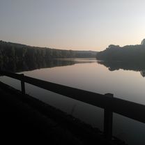
From Condrieu to Sablons via the Via Rhôna, return via the plateau south of Vienne
created this 12 years ago
Route quality
Quiet road
17.3 km
38 %
Road
9.1 km
20 %
Paved
39.6 km
(87 %)
Unpaved
1.4 km
(3 %)
Asphalt
39.6 km
87 %
Gravel
0.9 km
2 %
Continue with Bikemap
You would like to ride b1 Via Rhona au départ de Condrieu or customize it for your own trip? Here is what you can do with this Bikemap route:
Free trial for 3 days, or one-time payment. More about Bikemap Premium.
Discover more Premium features.
Get Bikemap PremiumFrom our community
Open it in the app