

Paradis * Raid Pyrénéen Jour 2
A cycling route starting in Arudy, Nouvelle-Aquitaine, France.
Overview
About this route
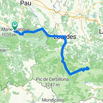
Arudy - Ste-Marie-de-Campan Col d'Aubisque Col de Soulor Col du Tourmalet
- -:--
- Duration
- 113.5 km
- Distance
- 4,497 m
- Ascent
- 3,531 m
- Descent
- ---
- Avg. speed
- 1,716 m
- Max. altitude

Route quality
Waytypes & surfaces along the route
Waytypes
Road
14.8 km
(13 %)
Quiet road
6.8 km
(6 %)
Surfaces
Paved
82.9 km
(73 %)
Unpaved
4.5 km
(4 %)
Asphalt
82.9 km
(73 %)
Ground
3.4 km
(3 %)
Continue with Bikemap
Use, edit, or download this cycling route
You would like to ride Paradis * Raid Pyrénéen Jour 2 or customize it for your own trip? Here is what you can do with this Bikemap route:
Free features
- Save this route as favorite or in collections
- Copy & plan your own version of this route
- Split it into stages to create a multi-day tour
- Sync your route with Garmin or Wahoo
Premium features
Free trial for 3 days, or one-time payment. More about Bikemap Premium.
- Navigate this route on iOS & Android
- Export a GPX / KML file of this route
- Create your custom printout (try it for free)
- Download this route for offline navigation
Discover more Premium features.
Get Bikemap PremiumFrom our community
Other popular routes starting in Arudy
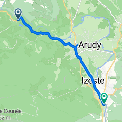 De Chemin de la Débarade 251, Arudy a Route d'Ossau 6-16, Izeste
- Distance
- 6.1 km
- Ascent
- 259 m
- Descent
- 168 m
- Location
- Arudy, Nouvelle-Aquitaine, France
 2014 Ride Day 84 - Bescat to Tarbes
- Distance
- 52.2 km
- Ascent
- 462 m
- Descent
- 578 m
- Location
- Arudy, Nouvelle-Aquitaine, France
 AANGEPASTE VARIANTE NAAR L'ETABLE D'OSSAU resto belg
- Distance
- 33 km
- Ascent
- 654 m
- Descent
- 655 m
- Location
- Arudy, Nouvelle-Aquitaine, France
 Marie Blnaque
- Distance
- 54 km
- Ascent
- 1,024 m
- Descent
- 1,024 m
- Location
- Arudy, Nouvelle-Aquitaine, France
 Arudy - Ortzanzurieta
- Distance
- 205 km
- Ascent
- 4,852 m
- Descent
- 3,709 m
- Location
- Arudy, Nouvelle-Aquitaine, France
 Goturen
- Distance
- 181 km
- Ascent
- 2,128 m
- Descent
- 2,128 m
- Location
- Arudy, Nouvelle-Aquitaine, France
 Paradis * Raid Pyrénéen Jour 2
- Distance
- 113.5 km
- Ascent
- 4,497 m
- Descent
- 3,531 m
- Location
- Arudy, Nouvelle-Aquitaine, France
 De Route Sainte Colome 33, Sévignacq-Meyracq a Chemin Départemental d'Arudy À Nay 13, Sainte-Colome
- Distance
- 3.8 km
- Ascent
- 43 m
- Descent
- 107 m
- Location
- Arudy, Nouvelle-Aquitaine, France
Open it in the app