

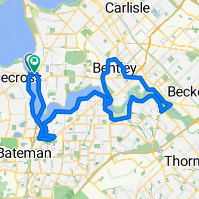
Hills Ride
A cycling route starting in Manning, Western Australia, Australia.
Overview
About this route
Canning Bridge to the hills and back
- -:--
- Duration
- 130.6 km
- Distance
- 987 m
- Ascent
- 991 m
- Descent
- ---
- Avg. speed
- ---
- Max. altitude
Route highlights
Points of interest along the route
Point of interest after 4.7 km
Continue with Bikemap
Use, edit, or download this cycling route
You would like to ride Hills Ride or customize it for your own trip? Here is what you can do with this Bikemap route:
Free features
- Save this route as favorite or in collections
- Copy & plan your own version of this route
- Split it into stages to create a multi-day tour
- Sync your route with Garmin or Wahoo
Premium features
Free trial for 3 days, or one-time payment. More about Bikemap Premium.
- Navigate this route on iOS & Android
- Export a GPX / KML file of this route
- Create your custom printout (try it for free)
- Download this route for offline navigation
Discover more Premium features.
Get Bikemap PremiumFrom our community
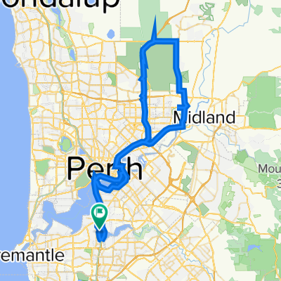
Other popular routes starting in Manning
 Hills Ride
- Distance
- 130.6 km
- Ascent
- 987 m
- Descent
- 991 m
- Location
- Manning, Western Australia, Australia
 Raffles Como - Shelley Foreshore - South Perth Loop
- Distance
- 28.7 km
- Ascent
- 87 m
- Descent
- 85 m
- Location
- Manning, Western Australia, Australia
 A river loop
- Distance
- 61.2 km
- Ascent
- 480 m
- Descent
- 478 m
- Location
- Manning, Western Australia, Australia
 Airport Loop
- Distance
- 76.5 km
- Ascent
- 648 m
- Descent
- 648 m
- Location
- Manning, Western Australia, Australia
 Lengthy ride through Perth
- Distance
- 36.6 km
- Ascent
- 109 m
- Descent
- 88 m
- Location
- Manning, Western Australia, Australia
 New Route
- Distance
- 41.9 km
- Ascent
- 74 m
- Descent
- 72 m
- Location
- Manning, Western Australia, Australia
 86 km - Mt Pleasant-Ellenbrook
- Distance
- 85.8 km
- Ascent
- 626 m
- Descent
- 629 m
- Location
- Manning, Western Australia, Australia
 Raffles - Curtin - Vic Park - South Perth
- Distance
- 32.1 km
- Ascent
- 196 m
- Descent
- 198 m
- Location
- Manning, Western Australia, Australia
Open it in the app