

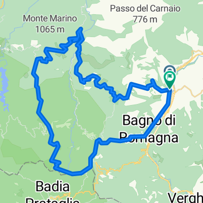
Bagno di Romagna - Rio Petroso - Pietrapazza - Zuccherodante
A cycling route starting in San Piero in Bagno, Emilia-Romagna, Italy.
Overview
About this route
Bagno di Romagna - Rio Petroso - Pietrapazza . Zuccherodante
- -:--
- Duration
- 37.5 km
- Distance
- 1,392 m
- Ascent
- 1,655 m
- Descent
- ---
- Avg. speed
- ---
- Max. altitude

Continue with Bikemap
Use, edit, or download this cycling route
You would like to ride Bagno di Romagna - Rio Petroso - Pietrapazza - Zuccherodante or customize it for your own trip? Here is what you can do with this Bikemap route:
Free features
- Save this route as favorite or in collections
- Copy & plan your own version of this route
- Sync your route with Garmin or Wahoo
Premium features
Free trial for 3 days, or one-time payment. More about Bikemap Premium.
- Navigate this route on iOS & Android
- Export a GPX / KML file of this route
- Create your custom printout (try it for free)
- Download this route for offline navigation
Discover more Premium features.
Get Bikemap PremiumFrom our community
Other popular routes starting in San Piero in Bagno
 Chiar d'Ovo con variante iniziale
- Distance
- 18.6 km
- Ascent
- 822 m
- Descent
- 822 m
- Location
- San Piero in Bagno, Emilia-Romagna, Italy
 Bagno di Romagna round trip
- Distance
- 22 km
- Ascent
- 803 m
- Descent
- 798 m
- Location
- San Piero in Bagno, Emilia-Romagna, Italy
 San Piero in Bagno - Corzano - Pian dei Riti - Gallerie
- Distance
- 25.4 km
- Ascent
- 1,099 m
- Descent
- 1,098 m
- Location
- San Piero in Bagno, Emilia-Romagna, Italy
 Around Bagno di Romagna 2
- Distance
- 120.4 km
- Ascent
- 2,770 m
- Descent
- 2,770 m
- Location
- San Piero in Bagno, Emilia-Romagna, Italy
 casentino forestale
- Distance
- 47.2 km
- Ascent
- 1,534 m
- Descent
- 1,537 m
- Location
- San Piero in Bagno, Emilia-Romagna, Italy
 Anello Pietrapazza
- Distance
- 40.7 km
- Ascent
- 948 m
- Descent
- 938 m
- Location
- San Piero in Bagno, Emilia-Romagna, Italy
 p21 Passo dei Mandrioli
- Distance
- 28.5 km
- Ascent
- 1,053 m
- Descent
- 1,168 m
- Location
- San Piero in Bagno, Emilia-Romagna, Italy
 San Pietro in Bagno - Camaldoli
- Distance
- 35.9 km
- Ascent
- 889 m
- Descent
- 621 m
- Location
- San Piero in Bagno, Emilia-Romagna, Italy
Open it in the app