

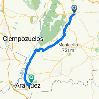
San Martín, Morata, Pico del Águila, Valdelecha
A cycling route starting in Morata de Tajuña, Madrid, Spain.
Overview
About this route
San Martín, Morata, Pico del Águila, Valdelecha. 125kms total.
- -:--
- Duration
- 124.8 km
- Distance
- 992 m
- Ascent
- 991 m
- Descent
- ---
- Avg. speed
- ---
- Max. altitude

Route quality
Waytypes & surfaces along the route
Waytypes
Busy road
74 km
(59 %)
Road
30.3 km
(24 %)
Surfaces
Paved
42.5 km
(34 %)
Unpaved
1.9 km
(2 %)
Asphalt
42.5 km
(34 %)
Ground
1.9 km
(2 %)
Undefined
80.4 km
(64 %)
Continue with Bikemap
Use, edit, or download this cycling route
You would like to ride San Martín, Morata, Pico del Águila, Valdelecha or customize it for your own trip? Here is what you can do with this Bikemap route:
Free features
- Save this route as favorite or in collections
- Copy & plan your own version of this route
- Split it into stages to create a multi-day tour
- Sync your route with Garmin or Wahoo
Premium features
Free trial for 3 days, or one-time payment. More about Bikemap Premium.
- Navigate this route on iOS & Android
- Export a GPX / KML file of this route
- Create your custom printout (try it for free)
- Download this route for offline navigation
Discover more Premium features.
Get Bikemap PremiumFrom our community
Other popular routes starting in Morata de Tajuña
 Route 11 Madrid to Barcelona Route
- Distance
- 725 km
- Ascent
- 2,496 m
- Descent
- 3,116 m
- Location
- Morata de Tajuña, Madrid, Spain
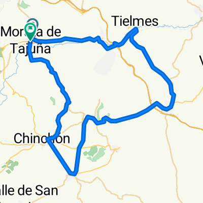
 Morata de Tajuña-Perales-Tielmes-Carabaña y vuelta
- Distance
- 44.9 km
- Ascent
- 256 m
- Descent
- 251 m
- Location
- Morata de Tajuña, Madrid, Spain
 Morata-Aranjuez
- Distance
- 32.8 km
- Ascent
- 63 m
- Descent
- 106 m
- Location
- Morata de Tajuña, Madrid, Spain
 Morata, Villarejo,Colmenar de Oreja
- Distance
- 57.8 km
- Ascent
- 3,087 m
- Descent
- 3,117 m
- Location
- Morata de Tajuña, Madrid, Spain
 Morata de Tajuña
- Distance
- 36.4 km
- Ascent
- 403 m
- Descent
- 440 m
- Location
- Morata de Tajuña, Madrid, Spain
 entrenamiento de fondo
- Distance
- 202.9 km
- Ascent
- 1,462 m
- Descent
- 1,399 m
- Location
- Morata de Tajuña, Madrid, Spain
 Morata de Tajuña - Ambite - Morata de Tajuña
- Distance
- 64.7 km
- Ascent
- 150 m
- Descent
- 151 m
- Location
- Morata de Tajuña, Madrid, Spain
 De Calle del Carmen, Morata de Tajuña a M-313, Morata de Tajuña
- Distance
- 26 km
- Ascent
- 366 m
- Descent
- 368 m
- Location
- Morata de Tajuña, Madrid, Spain
Open it in the app