
Bad Herrenalb - Karlsruhe (Pfahlwaldweg - Richard Massinger Weg - Saumweg)
A cycling route starting in Bad Herrenalb, Baden-Wurttemberg, Germany.
Overview
About this route
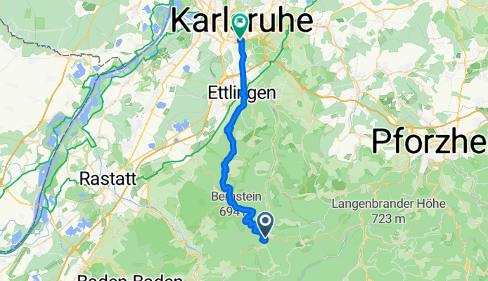
From Bad Herrenalb to Karlsruhe via Ettlingen. From Bad Herrenalb station, it goes steeply uphill towards Bernstein on the Pfahlwaldweg path to Freiolsheim, from Freiolsheim we follow the Richard Massinger path to Rimmelsbacher Hof (Völkersbach). From Rimmelsbacher Hof, it goes downhill towards Ettlingen until we reach the Saumweg path. From there, we follow the Saumweg path to Ettlingen.
The tour takes about 2.5 - 3 hours and has a small to medium difficulty level!
- -:--
- Duration
- 30.9 km
- Distance
- 301 m
- Ascent
- 544 m
- Descent
- ---
- Avg. speed
- ---
- Max. altitude

Route quality
Waytypes & surfaces along the route
Waytypes
Track
18.5 km
(60 %)
Quiet road
4.3 km
(14 %)
Surfaces
Paved
16.1 km
(52 %)
Unpaved
13.6 km
(44 %)
Asphalt
15.1 km
(49 %)
Gravel
11.4 km
(37 %)
Continue with Bikemap
Use, edit, or download this cycling route
You would like to ride Bad Herrenalb - Karlsruhe (Pfahlwaldweg - Richard Massinger Weg - Saumweg) or customize it for your own trip? Here is what you can do with this Bikemap route:
Free features
- Save this route as favorite or in collections
- Copy & plan your own version of this route
- Sync your route with Garmin or Wahoo
Premium features
Free trial for 3 days, or one-time payment. More about Bikemap Premium.
- Navigate this route on iOS & Android
- Export a GPX / KML file of this route
- Create your custom printout (try it for free)
- Download this route for offline navigation
Discover more Premium features.
Get Bikemap PremiumFrom our community
Other popular routes starting in Bad Herrenalb
 Grosse Felsen-Runde (KONUS)
- Distance
- 42.9 km
- Ascent
- 1,221 m
- Descent
- 1,220 m
- Location
- Bad Herrenalb, Baden-Wurttemberg, Germany
 Bad Herrenalb - Karlsruhe (Pfahlwaldweg - Richard Massinger Weg - Saumweg)
- Distance
- 30.9 km
- Ascent
- 301 m
- Descent
- 544 m
- Location
- Bad Herrenalb, Baden-Wurttemberg, Germany
 Wandertour Bad Herrenalb Quellweg
- Distance
- 10.5 km
- Ascent
- 295 m
- Descent
- 292 m
- Location
- Bad Herrenalb, Baden-Wurttemberg, Germany
 Rund um Bad Herrenalb
- Distance
- 17.9 km
- Ascent
- 579 m
- Descent
- 579 m
- Location
- Bad Herrenalb, Baden-Wurttemberg, Germany
 Bad Herrenalb - Teufelsmühle - Kaltenbronn - Eyachmühle - Dobel - Bad Herrenalb
- Distance
- 48.4 km
- Ascent
- 993 m
- Descent
- 993 m
- Location
- Bad Herrenalb, Baden-Wurttemberg, Germany
 Bernstein + Teufelsmühle
- Distance
- 29 km
- Ascent
- 763 m
- Descent
- 764 m
- Location
- Bad Herrenalb, Baden-Wurttemberg, Germany
 Bad Herrenalber Runde über Bernstein
- Distance
- 21.7 km
- Ascent
- 550 m
- Descent
- 550 m
- Location
- Bad Herrenalb, Baden-Wurttemberg, Germany
 Pfrot-Kaltenbronn-Pfrot
- Distance
- 52.3 km
- Ascent
- 1,073 m
- Descent
- 1,066 m
- Location
- Bad Herrenalb, Baden-Wurttemberg, Germany
Open it in the app