


BCB. Morciencuentros 4. Villarcayo-Espinosa de los Monteros
- 44.4 km
- 560 m
- 403 m
- Medina de Pomar, Castille and León, Spain
A cycling route starting in Medina de Pomar, Castille and León, Spain.
Overview
Day 4
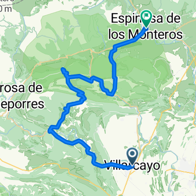
July 9 (Wednesday) We leave on the BU 561, passing through Ciguenza towards Puentedey. We enter Puentedey, one of the most beautiful corners of Burgos; the village built atop the natural arch formed by the Nela River flowing below through its natural tunnel. After enjoying the village and the river, we must exit beneath the old tracks passing through a tunnel towards Quintanilla Valdebodres. Just about one kilometer ahead, on the left, we pass a sign for the Mea waterfall; in summer, there will be very little water. We follow the road, passing through some villages until Ahedo de Linares. After the village, we take a left onto a road that climbs. Then we arrive at a junction and continue straight until we reach the monument of Ojo Guareña and the hermitage of Sta Bernabe, all very beautiful; we ate there. Leaving the site, we must climb again to the parking lot; just about a hundred meters away there is a very cool 'parliament' tree. Descending back to the junction, we turn left towards Cornejo. Leaving Cornejo on BU 562, towards Villarcayo. In Hornillayuso, we turn left again towards the C 6318. When we reach the national road, we turn right towards Espinosa.created this 11 years ago
Route quality
Road
23.6 km
(53 %)
Quiet road
2.2 km
(5 %)
Undefined
18.7 km
(42 %)
Paved
42.7 km
(96 %)
Asphalt
42.7 km
(96 %)
Undefined
1.8 km
(4 %)
Continue with Bikemap
You would like to ride BCB. Morciencuentros 4. Villarcayo-Espinosa de los Monteros or customize it for your own trip? Here is what you can do with this Bikemap route:
Free trial for 3 days, or one-time payment. More about Bikemap Premium.
Discover more Premium features.
Get Bikemap PremiumFrom our community
Open it in the app


