

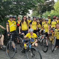
alp neckertal
A cycling route starting in Tübingen, Baden-Wurttemberg, Germany.
Overview
About this route
connection of individual segments but also new elements
- -:--
- Duration
- 130.1 km
- Distance
- 1,642 m
- Ascent
- 1,570 m
- Descent
- ---
- Avg. speed
- 932 m
- Max. altitude

Route quality
Waytypes & surfaces along the route
Waytypes
Road
27.3 km
(21 %)
Quiet road
13 km
(10 %)
Surfaces
Paved
100.2 km
(77 %)
Unpaved
3.9 km
(3 %)
Asphalt
98.9 km
(76 %)
Ground
2.6 km
(2 %)
Continue with Bikemap
Use, edit, or download this cycling route
You would like to ride alp neckertal or customize it for your own trip? Here is what you can do with this Bikemap route:
Free features
- Save this route as favorite or in collections
- Copy & plan your own version of this route
- Split it into stages to create a multi-day tour
- Sync your route with Garmin or Wahoo
Premium features
Free trial for 3 days, or one-time payment. More about Bikemap Premium.
- Navigate this route on iOS & Android
- Export a GPX / KML file of this route
- Create your custom printout (try it for free)
- Download this route for offline navigation
Discover more Premium features.
Get Bikemap PremiumFrom our community
Other popular routes starting in Tübingen
 20220813 Bad Urach a
- Distance
- 48.3 km
- Ascent
- 526 m
- Descent
- 419 m
- Location
- Tübingen, Baden-Wurttemberg, Germany
 alp neckertal
- Distance
- 130.1 km
- Ascent
- 1,642 m
- Descent
- 1,570 m
- Location
- Tübingen, Baden-Wurttemberg, Germany
 Schönbuch-Runde
- Distance
- 33.5 km
- Ascent
- 257 m
- Descent
- 255 m
- Location
- Tübingen, Baden-Wurttemberg, Germany
 ETT 2022 Gesamte Strecke
- Distance
- 877.3 km
- Ascent
- 6,381 m
- Descent
- 6,375 m
- Location
- Tübingen, Baden-Wurttemberg, Germany
 French Quarter to Baggersee
- Distance
- 8.7 km
- Ascent
- 0 m
- Descent
- 0 m
- Location
- Tübingen, Baden-Wurttemberg, Germany
 2017-02-01-H-Hirsch-Vitalia-A
- Distance
- 8.3 km
- Ascent
- 136 m
- Descent
- 138 m
- Location
- Tübingen, Baden-Wurttemberg, Germany
 Tübingen - Schadensweiler Hof - Tübingen
- Distance
- 36.1 km
- Ascent
- 235 m
- Descent
- 235 m
- Location
- Tübingen, Baden-Wurttemberg, Germany
 Tübingen-Holzgerlingen-Altdorf-Herrenberg-Tübingen
- Distance
- 54.5 km
- Ascent
- 457 m
- Descent
- 420 m
- Location
- Tübingen, Baden-Wurttemberg, Germany
Open it in the app