

24 Mile Adamant Loop/Montpelier
A cycling route starting in Montpelier, Vermont, United States of America.
Overview
About this route
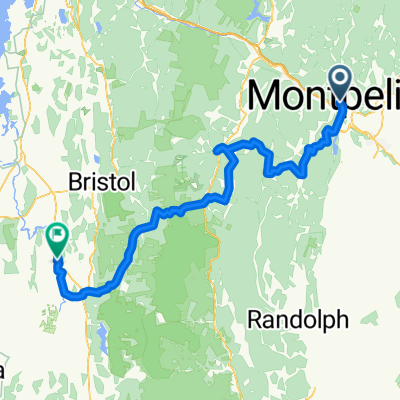
This is the 24 mile Adamant Loop for the Onion River Century Ride.
It's hilly with some sections that would be considered long steep hills for newer riders. It is half dirt, half paved, but absolutely beautiful. Very rural, quiet and low traffic.
- -:--
- Duration
- 38 km
- Distance
- 449 m
- Ascent
- 449 m
- Descent
- ---
- Avg. speed
- ---
- Avg. speed
Continue with Bikemap
Use, edit, or download this cycling route
You would like to ride 24 Mile Adamant Loop/Montpelier or customize it for your own trip? Here is what you can do with this Bikemap route:
Free features
- Save this route as favorite or in collections
- Copy & plan your own version of this route
- Sync your route with Garmin or Wahoo
Premium features
Free trial for 3 days, or one-time payment. More about Bikemap Premium.
- Navigate this route on iOS & Android
- Export a GPX / KML file of this route
- Create your custom printout (try it for free)
- Download this route for offline navigation
Discover more Premium features.
Get Bikemap PremiumFrom our community
Other popular routes starting in Montpelier
 Montpelier - Rutland
- Distance
- 112.9 km
- Ascent
- 1,286 m
- Descent
- 1,137 m
- Location
- Montpelier, Vermont, United States of America
 June Loop
- Distance
- 26.3 km
- Ascent
- 337 m
- Descent
- 337 m
- Location
- Montpelier, Vermont, United States of America
 Sodom Pond Loop
- Distance
- 13.7 km
- Ascent
- 153 m
- Descent
- 159 m
- Location
- Montpelier, Vermont, United States of America
 D3 Mtn Barre to Jeffersonville
- Distance
- 76.1 km
- Ascent
- 620 m
- Descent
- 633 m
- Location
- Montpelier, Vermont, United States of America
 Montpelier circulator
- Distance
- 11.8 km
- Ascent
- 83 m
- Descent
- 87 m
- Location
- Montpelier, Vermont, United States of America
 Bikepacking-Route-Green_Mountain_Gravel_Growler_v2
- Distance
- 103.2 km
- Ascent
- 2,420 m
- Descent
- 2,477 m
- Location
- Montpelier, Vermont, United States of America
 Montpellier, VT - Mt. Equinox, VT
- Distance
- 238.6 km
- Ascent
- 2,001 m
- Descent
- 1,116 m
- Location
- Montpelier, Vermont, United States of America
 Montpellier, VT - Equinox Mountain, VT
- Distance
- 169.8 km
- Ascent
- 2,072 m
- Descent
- 1,196 m
- Location
- Montpelier, Vermont, United States of America
Open it in the app