

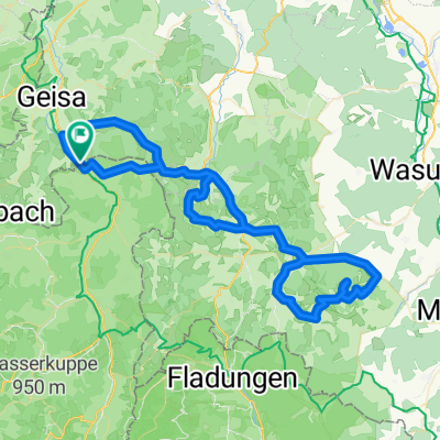
Tann-Frankenheim-Fladungen-Hohe Geba-Kaltennordheim
A cycling route starting in Schleid, Thuringia, Germany.
Overview
About this route
still to ride
- -:--
- Duration
- 90.4 km
- Distance
- 1,453 m
- Ascent
- 1,453 m
- Descent
- ---
- Avg. speed
- ---
- Max. altitude

Route quality
Waytypes & surfaces along the route
Waytypes
Road
38 km
(42 %)
Quiet road
22.6 km
(25 %)
Surfaces
Paved
52.4 km
(58 %)
Unpaved
2.7 km
(3 %)
Asphalt
46.1 km
(51 %)
Paved (undefined)
6.3 km
(7 %)
Continue with Bikemap
Use, edit, or download this cycling route
You would like to ride Tann-Frankenheim-Fladungen-Hohe Geba-Kaltennordheim or customize it for your own trip? Here is what you can do with this Bikemap route:
Free features
- Save this route as favorite or in collections
- Copy & plan your own version of this route
- Split it into stages to create a multi-day tour
- Sync your route with Garmin or Wahoo
Premium features
Free trial for 3 days, or one-time payment. More about Bikemap Premium.
- Navigate this route on iOS & Android
- Export a GPX / KML file of this route
- Create your custom printout (try it for free)
- Download this route for offline navigation
Discover more Premium features.
Get Bikemap PremiumFrom our community
Other popular routes starting in Schleid
 Motzlar - Kuhberg - Habelberg - Motzlar
- Distance
- 34 km
- Ascent
- 537 m
- Descent
- 537 m
- Location
- Schleid, Thuringia, Germany
 Tann-Frankenheim-Fladungen-Hohe Geba-Kaltennordheim
- Distance
- 90.4 km
- Ascent
- 1,453 m
- Descent
- 1,453 m
- Location
- Schleid, Thuringia, Germany
 Druch die thueringische Rhoen
- Distance
- 116.5 km
- Ascent
- 1,670 m
- Descent
- 1,670 m
- Location
- Schleid, Thuringia, Germany
 Motzlar - Großentaft - Vacha - Oechsen - Motzlar
- Distance
- 65.2 km
- Ascent
- 627 m
- Descent
- 630 m
- Location
- Schleid, Thuringia, Germany
 Rhönrunde mit Weitblick 1
- Distance
- 128.7 km
- Ascent
- 1,291 m
- Descent
- 1,291 m
- Location
- Schleid, Thuringia, Germany
 Motzlar - Erfurt - Halle - Potzdam - Müritzsee
- Distance
- 545.6 km
- Ascent
- 946 m
- Descent
- 1,187 m
- Location
- Schleid, Thuringia, Germany
 Recovered Route
- Distance
- 37.9 km
- Ascent
- 931 m
- Descent
- 320 m
- Location
- Schleid, Thuringia, Germany
 Von Tann zur Hohen Geba
- Distance
- 81.6 km
- Ascent
- 1,332 m
- Descent
- 1,333 m
- Location
- Schleid, Thuringia, Germany
Open it in the app