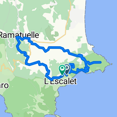
Friedel_geplante_Route_1
A cycling route starting in Ramatuelle, Provence-Alpes-C么te d'Azur Region, France.
Overview
About this route
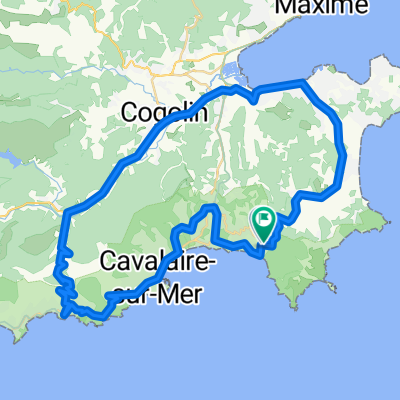
Test route 1 for the training camp
- -:--
- Duration
- 112.7 km
- Distance
- 1,201 m
- Ascent
- 1,201 m
- Descent
- ---
- Avg. speed
- ---
- Max. altitude
Route quality
Waytypes & surfaces along the route
Waytypes
Road
42.8 km
(38 %)
Quiet road
27 km
(24 %)
Surfaces
Paved
92.4 km
(82 %)
Asphalt
92.4 km
(82 %)
Undefined
20.3 km
(18 %)
Continue with Bikemap
Use, edit, or download this cycling route
You would like to ride Friedel_geplante_Route_1 or customize it for your own trip? Here is what you can do with this Bikemap route:
Free features
- Save this route as favorite or in collections
- Copy & plan your own version of this route
- Split it into stages to create a multi-day tour
- Sync your route with Garmin or Wahoo
Premium features
Free trial for 3 days, or one-time payment. More about Bikemap Premium.
- Navigate this route on iOS & Android
- Export a GPX / KML file of this route
- Create your custom printout (try it for free)
- Download this route for offline navigation
Discover more Premium features.
Get Bikemap PremiumFrom our community
Other popular routes starting in Ramatuelle
- Gigaro 60
- Distance
- 59.1 km
- Ascent
- 589 m
- Descent
- 583 m
- Location
- Ramatuelle, Provence-Alpes-C么te d'Azur Region, France
- Ramatuelle1
- Distance
- 25.3 km
- Ascent
- 406 m
- Descent
- 407 m
- Location
- Ramatuelle, Provence-Alpes-C么te d'Azur Region, France
- Le Plan De La Tour, ST Tropez
- Distance
- 66.4 km
- Ascent
- 850 m
- Descent
- 959 m
- Location
- Ramatuelle, Provence-Alpes-C么te d'Azur Region, France
- C么te d鈥橝zur 2016 - Ramatuelle - Saint Tropez
- Distance
- 38.9 km
- Ascent
- 627 m
- Descent
- 627 m
- Location
- Ramatuelle, Provence-Alpes-C么te d'Azur Region, France
- Rundtour Ramatuelle
- Distance
- 47.6 km
- Ascent
- 789 m
- Descent
- 788 m
- Location
- Ramatuelle, Provence-Alpes-C么te d'Azur Region, France
- 679 Chemin de la Douane, Ramatuelle 脿 484 Route de Tahiti, Ramatuelle
- Distance
- 11.6 km
- Ascent
- 204 m
- Descent
- 221 m
- Location
- Ramatuelle, Provence-Alpes-C么te d'Azur Region, France
- Barcelona 13
- Distance
- 74.1 km
- Ascent
- 398 m
- Descent
- 402 m
- Location
- Ramatuelle, Provence-Alpes-C么te d'Azur Region, France
- Ramatuelle na vychod po poloostrove a plazach
- Distance
- 18 km
- Ascent
- 516 m
- Descent
- 517 m
- Location
- Ramatuelle, Provence-Alpes-C么te d'Azur Region, France
Open it in the app