

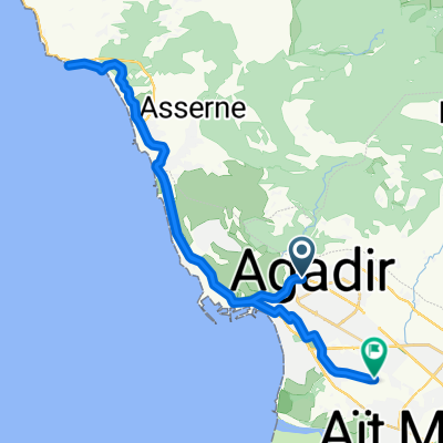
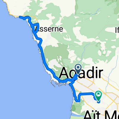
MS02 Agadir Ibis Hotel - Immesouane
A cycling route starting in Agadir, Région de Souss-Massa-Drâa, Morocco.
Overview
About this route
Auf dem Weg von Marokko nach Spanien.
- -:--
- Duration
- 99 km
- Distance
- 804 m
- Ascent
- 814 m
- Descent
- ---
- Avg. speed
- ---
- Max. altitude

Route quality
Waytypes & surfaces along the route
Waytypes
Cycleway
18.8 km
(19 %)
Road
15.8 km
(16 %)
Surfaces
Paved
67.3 km
(68 %)
Asphalt
65.4 km
(66 %)
Paved (undefined)
1 km
(1 %)
Continue with Bikemap
Use, edit, or download this cycling route
You would like to ride MS02 Agadir Ibis Hotel - Immesouane or customize it for your own trip? Here is what you can do with this Bikemap route:
Free features
- Save this route as favorite or in collections
- Copy & plan your own version of this route
- Split it into stages to create a multi-day tour
- Sync your route with Garmin or Wahoo
Premium features
Free trial for 3 days, or one-time payment. More about Bikemap Premium.
- Navigate this route on iOS & Android
- Export a GPX / KML file of this route
- Create your custom printout (try it for free)
- Download this route for offline navigation
Discover more Premium features.
Get Bikemap PremiumFrom our community
Other popular routes starting in Agadir
 Besuch des Souk in Agadir
- Distance
- 10.4 km
- Ascent
- 288 m
- Descent
- 291 m
- Location
- Agadir, Région de Souss-Massa-Drâa, Morocco
 Aga-Cap Ghir-Aga
- Distance
- 101.8 km
- Ascent
- 460 m
- Descent
- 460 m
- Location
- Agadir, Région de Souss-Massa-Drâa, Morocco
 Agadir - Azerag - Taroudannt
- Distance
- 80.8 km
- Ascent
- 391 m
- Descent
- 194 m
- Location
- Agadir, Région de Souss-Massa-Drâa, Morocco
 De Hopital Hassan à Avenue Laayoune
- Distance
- 55.3 km
- Ascent
- 652 m
- Descent
- 738 m
- Location
- Agadir, Région de Souss-Massa-Drâa, Morocco
 Agadir-Tafraoute-Tiznit-Agadir
- Distance
- 386.3 km
- Ascent
- 2,970 m
- Descent
- 2,970 m
- Location
- Agadir, Région de Souss-Massa-Drâa, Morocco
 marokko_versie2a
- Distance
- 551.5 km
- Ascent
- 3,090 m
- Descent
- 2,205 m
- Location
- Agadir, Région de Souss-Massa-Drâa, Morocco
 De Hopital Hassan à Avenue Laayoune
- Distance
- 65.7 km
- Ascent
- 903 m
- Descent
- 1,014 m
- Location
- Agadir, Région de Souss-Massa-Drâa, Morocco
 De Marin Pecheur à Avenue Laayoune
- Distance
- 61 km
- Ascent
- 636 m
- Descent
- 743 m
- Location
- Agadir, Région de Souss-Massa-Drâa, Morocco
Open it in the app