Przejście po Połonienie Wetlińskiej wersja łatwa
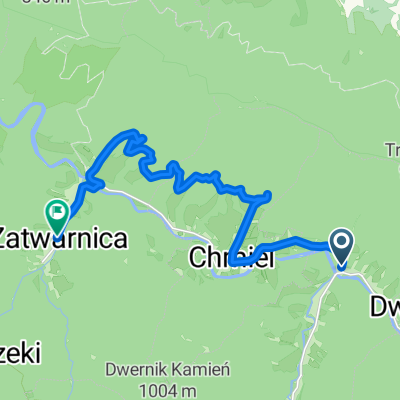
- 13.1 km
- 495 m
- 752 m
- Lutowiska, Subcarpathian Voivodeship, Poland
A cycling route starting in Lutowiska, Subcarpathian Voivodeship, Poland.
Overview
2013-08-15 Bieszczady. Bicycle. Along the Otryt Range on both sides of the San.
created this 12 years ago
Continue with Bikemap
You would like to ride 2013-08-15 Bieszczady. Rower. Wzdłuż Pasma Otrytu po obu stronach Sanu. or customize it for your own trip? Here is what you can do with this Bikemap route:
Free trial for 3 days, or one-time payment. More about Bikemap Premium.
Discover more Premium features.
Get Bikemap PremiumFrom our community
Open it in the app