

Puentelarrá montes Obarenes
A cycling route starting in Santa Gadea del Cid, Castille and León, Spain.
Overview
About this route
Puentelarrá Montes Obarenes, Frías
- -:--
- Duration
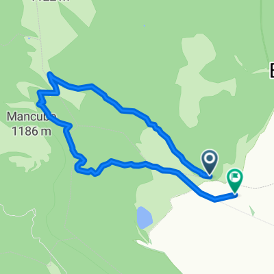
- 69.3 km
- Distance
- 693 m
- Ascent
- 693 m
- Descent
- ---
- Avg. speed
- ---
- Max. altitude

Route quality
Waytypes & surfaces along the route
Waytypes
Quiet road
11.8 km
(17 %)
Road
9.7 km
(14 %)
Undefined
47.8 km
(69 %)
Surfaces
Paved
55.4 km
(80 %)
Asphalt
55.4 km
(80 %)
Undefined
13.9 km
(20 %)
Continue with Bikemap
Use, edit, or download this cycling route
You would like to ride Puentelarrá montes Obarenes or customize it for your own trip? Here is what you can do with this Bikemap route:
Free features
- Save this route as favorite or in collections
- Copy & plan your own version of this route
- Sync your route with Garmin or Wahoo
Premium features
Free trial for 3 days, or one-time payment. More about Bikemap Premium.
- Navigate this route on iOS & Android
- Export a GPX / KML file of this route
- Create your custom printout (try it for free)
- Download this route for offline navigation
Discover more Premium features.
Get Bikemap PremiumFrom our community
Other popular routes starting in Santa Gadea del Cid
 Vuelta de Puentelarrá a Oña
- Distance
- 98.6 km
- Ascent
- 554 m
- Descent
- 554 m
- Location
- Santa Gadea del Cid, Castille and León, Spain
 Robledal Bozoo
- Distance
- 8.8 km
- Ascent
- 1,486 m
- Descent
- 1,493 m
- Location
- Santa Gadea del Cid, Castille and León, Spain
 De Santa Gadea del Cid a Santa Gadea del Cid
- Distance
- 105.2 km
- Ascent
- 698 m
- Descent
- 698 m
- Location
- Santa Gadea del Cid, Castille and León, Spain
 De Bergonda a Bergonda
- Distance
- 78.8 km
- Ascent
- 610 m
- Descent
- 607 m
- Location
- Santa Gadea del Cid, Castille and León, Spain
 Bilbao 2
- Distance
- 80.6 km
- Ascent
- 576 m
- Descent
- 1,049 m
- Location
- Santa Gadea del Cid, Castille and León, Spain
 Encio-Frias-La Horca-Encio
- Distance
- 96.6 km
- Ascent
- 1,042 m
- Descent
- 1,042 m
- Location
- Santa Gadea del Cid, Castille and León, Spain
 Puentelarrá montes Obarenes
- Distance
- 69.3 km
- Ascent
- 693 m
- Descent
- 693 m
- Location
- Santa Gadea del Cid, Castille and León, Spain
 Puentelarrá-Puentelarrá por el Portillo
- Distance
- 77 km
- Ascent
- 692 m
- Descent
- 692 m
- Location
- Santa Gadea del Cid, Castille and León, Spain
Open it in the app