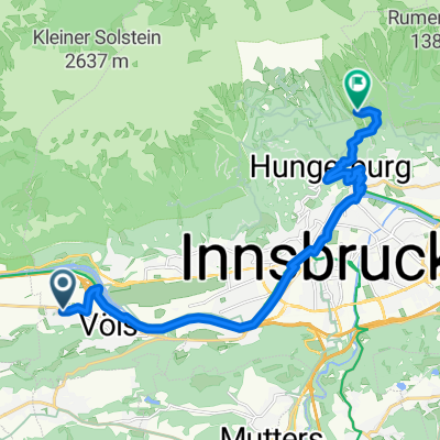
Rauschbrunnen
- 2.8 km
- 11 m
- 452 m
- Völs, Tyrol, Austria
A cycling route starting in Völs, Tyrol, Austria.
Overview
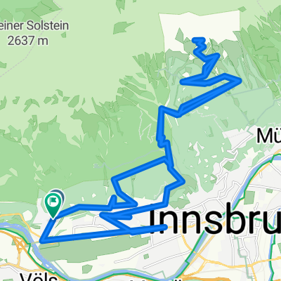
Scenically very beautiful pass Had to battle with the cows and of course with the mountain, which has quite a few steep sections on both sides, as I went there and back
created this 16 years ago
Route quality
Quiet road
2.2 km
(4 %)
Track
1.1 km
(2 %)
Paved
48.7 km
(88 %)
Asphalt
48.7 km
(88 %)
Undefined
6.6 km
(12 %)
Continue with Bikemap
You would like to ride Kühtai Sattel 2009 or customize it for your own trip? Here is what you can do with this Bikemap route:
Free trial for 3 days, or one-time payment. More about Bikemap Premium.
Discover more Premium features.
Get Bikemap PremiumFrom our community
Open it in the app