

Sugar Ridge / Theta
A cycling route starting in Spring Hill, Tennessee, United States.
Overview
About this route
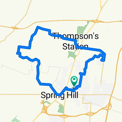
Extension of Sugar Ridge Route to include the climb up to Theta. Gravel Hill Rd is not gravel, but it isn't the best paved surface either.
- -:--
- Duration
- 53.9 km
- Distance
- 411 m
- Ascent
- 390 m
- Descent
- ---
- Avg. speed
- 306 m
- Max. altitude
Route quality
Waytypes & surfaces along the route
Waytypes
Quiet road
34.5 km
(64 %)
Road
9.2 km
(17 %)
Surfaces
Paved
24.8 km
(46 %)
Asphalt
24.8 km
(46 %)
Undefined
29.1 km
(54 %)
Continue with Bikemap
Use, edit, or download this cycling route
You would like to ride Sugar Ridge / Theta or customize it for your own trip? Here is what you can do with this Bikemap route:
Free features
- Save this route as favorite or in collections
- Copy & plan your own version of this route
- Sync your route with Garmin or Wahoo
Premium features
Free trial for 3 days, or one-time payment. More about Bikemap Premium.
- Navigate this route on iOS & Android
- Export a GPX / KML file of this route
- Create your custom printout (try it for free)
- Download this route for offline navigation
Discover more Premium features.
Get Bikemap PremiumFrom our community
Other popular routes starting in Spring Hill
 Grainger Springs 1600, Spring Hill to Grainger Springs 1600, Spring Hill
- Distance
- 18.6 km
- Ascent
- 56 m
- Descent
- 32 m
- Location
- Spring Hill, Tennessee, United States
 Humphreys Glen 1725, Spring Hill to Grainger Springs 1600, Spring Hill
- Distance
- 17.9 km
- Ascent
- 64 m
- Descent
- 33 m
- Location
- Spring Hill, Tennessee, United States
 home backroads
- Distance
- 25.2 km
- Ascent
- 384 m
- Descent
- 391 m
- Location
- Spring Hill, Tennessee, United States
 Sugar Ridge / Short
- Distance
- 21.9 km
- Ascent
- 140 m
- Descent
- 133 m
- Location
- Spring Hill, Tennessee, United States
 Grainger Springs 1604, Spring Hill to Grainger Springs 1600, Spring Hill
- Distance
- 8.7 km
- Ascent
- 45 m
- Descent
- 18 m
- Location
- Spring Hill, Tennessee, United States
 Grainger Springs 1600, Spring Hill to Grainger Springs 1600, Spring Hill
- Distance
- 13.1 km
- Ascent
- 56 m
- Descent
- 27 m
- Location
- Spring Hill, Tennessee, United States
 Sugar Ridge
- Distance
- 31.8 km
- Ascent
- 202 m
- Descent
- 184 m
- Location
- Spring Hill, Tennessee, United States
 Local backroads
- Distance
- 35.8 km
- Ascent
- 219 m
- Descent
- 217 m
- Location
- Spring Hill, Tennessee, United States
Open it in the app