

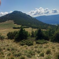
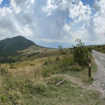
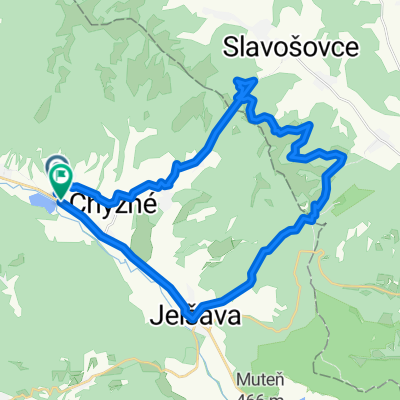
SLOVAKIA 2009.07.12. Királyhegy
A cycling route starting in Revúca, Banská Bystrica Region, Slovakia.
Overview
About this route
- -:--
- Duration
- 5.6 km
- Distance
- 1,056 m
- Ascent
- 5 m
- Descent
- ---
- Avg. speed
- ---
- Max. altitude

Route highlights
Points of interest along the route

Point of interest after 0 km

Point of interest after 0.6 km

Point of interest after 5.6 km
Continue with Bikemap
Use, edit, or download this cycling route
You would like to ride SLOVAKIA 2009.07.12. Királyhegy or customize it for your own trip? Here is what you can do with this Bikemap route:
Free features
- Save this route as favorite or in collections
- Copy & plan your own version of this route
- Sync your route with Garmin or Wahoo
Premium features
Free trial for 3 days, or one-time payment. More about Bikemap Premium.
- Navigate this route on iOS & Android
- Export a GPX / KML file of this route
- Create your custom printout (try it for free)
- Download this route for offline navigation
Discover more Premium features.
Get Bikemap PremiumFrom our community
Other popular routes starting in Revúca
 Kráľová Hoľa
- Distance
- 23.2 km
- Ascent
- 1,171 m
- Descent
- 1,172 m
- Location
- Revúca, Banská Bystrica Region, Slovakia
 Šumiac do Šumiac
- Distance
- 34.1 km
- Ascent
- 1,019 m
- Descent
- 1,019 m
- Location
- Revúca, Banská Bystrica Region, Slovakia
 Predná Hora - Muráňský Hrad, Muráň
- Distance
- 8.8 km
- Ascent
- 318 m
- Descent
- 750 m
- Location
- Revúca, Banská Bystrica Region, Slovakia
 Muráň až Rudná Magistrála, Muráň
- Distance
- 1.5 km
- Ascent
- 78 m
- Descent
- 43 m
- Location
- Revúca, Banská Bystrica Region, Slovakia
 Juraja Kriváňa, Šumiac až Bučinka, Šumiac
- Distance
- 31.6 km
- Ascent
- 1,235 m
- Descent
- 1,240 m
- Location
- Revúca, Banská Bystrica Region, Slovakia
 Šumiac do Kráľovohoľská cesta
- Distance
- 12.1 km
- Ascent
- 1,083 m
- Descent
- 38 m
- Location
- Revúca, Banská Bystrica Region, Slovakia
 Revúca-M.Zdychava- Sev. Lúka- Č.Skala - Pr.Hora
- Distance
- 47.4 km
- Ascent
- 1,563 m
- Descent
- 1,563 m
- Location
- Revúca, Banská Bystrica Region, Slovakia
 Trasa z Revúcka Lehota do Parkovisko
- Distance
- 34.6 km
- Ascent
- 1,005 m
- Descent
- 1,007 m
- Location
- Revúca, Banská Bystrica Region, Slovakia
Open it in the app