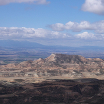
Alto de San Esteban

A cycling route starting in Almozara, Aragon, Spain.
OverviewAbout this route

On the road to Huesca. Towards Villanueva de Gállego, then take the road to Castejón up to the Alto de San Esteban.

Translated, show original (Spanish)
-:--
Duration
72.5 km
Distance
519 m
Ascent
515 m
Descent
---
Avg. speed
---
Max. altitude
Jose Manuel Lopezcreated this 12 years ago
Route qualityWaytypes & surfaces along the route
Waytypes
  • Quiet road

    12.3 km17 %
  • Cycleway

    10.9 km15 %
  • Track

    6.5 km9 %
Surfaces

Paved

10.1 km(14 %)
  • Asphalt

    8.7 km12 %
  • Paved (undefined)

    0.7 km1 %
  • Concrete

    0.7 km1 %
Continue with BikemapUse, edit, or download this cycling route
You would like to ride Alto de San Esteban or customize it for your own trip? Here is what you can do with this Bikemap route:
Free features
Premium features

Free trial for 3 days, or one-time payment. More about Bikemap Premium.

  • Navigate this route on iOS & Android
  • Export a GPX / KML file of this route
  • Create your custom printout (try it for free)
  • Download this route for offline navigation

Discover more Premium features.

Get Bikemap Premium
From our communityOther popular routes starting in Almozara

Open it in the app