Brötchen Tour
A cycling route starting in Berumbur, Lower Saxony, Germany.
Overview
About this route
The Bread Roll Route is for early risers who don’t necessarily want to get their bread roll from the bakery next door, but rather combine it with a fitness route. It’s best to cycle this route at early sunrise with an east wind, as it’s always a bit windy on the dyke. From Berumbur at 4:30 a.m., you head straight to Hilgenriedersiel along the dyke, where depending on the time, you can nicely observe the sunrise. In good visibility, you can see the islands of Norderney, Baltrum, Langeoog, Spiekeroog, and Wangerooge along the dyke. It’s a fully asphalted path up to Bensersiel before the dyke (land side) and from Bensersiel behind the dyke (sea side). The stretch between Bensersiel and Neuharlingersiel might be a bit dirty due to sheep droppings. Around Ostbense, if the tide is right, you can take a little cool off in the waves (so don’t forget the towel). In Neuharlingersiel, we cycle around the former ferry house and circle the harbor with its fishing boats. Arriving at the bakery, we get inspired by the picturesque harbor while enjoying a coffee and a topped bread roll (bakery opening hours Mon-Sat from 6:30 a.m., Sun from 7 a.m.). From then on, we head back home along the dyke with an onshore east wind.
- -:--
- Duration
- 40.1 km
- Distance
- 13 m
- Ascent
- 12 m
- Descent
- ---
- Avg. speed
- 13 m
- Max. altitude
Route quality
Waytypes & surfaces along the route
Waytypes
Access road
12.8 km
(32 %)
Quiet road
11.6 km
(29 %)
Surfaces
Paved
26.8 km
(67 %)
Unpaved
2.8 km
(7 %)
Asphalt
26.4 km
(66 %)
Ground
2.8 km
(7 %)
Route highlights
Points of interest along the route

Point of interest after 0.2 km
Berumbur, Holzdorfer Str. Ecke Garrelts Land

Point of interest after 1.9 km
Berumer Allee Richtung Hage

Point of interest after 2 km
Burg Berum

Point of interest after 2.5 km
Windmühle in Hage

Point of interest after 4.3 km
Hagermarscher Str. Richtung Hage

Point of interest after 7.2 km
Alter Postweg Richtung Hagermarsch

Point of interest after 8.2 km
Kurz vorm Sommerdeich in Hilgenriedersiel

Point of interest after 9.5 km
kurz vor Hilgenriedersiel

Point of interest after 10.7 km
Sonnenaufgang über Baltrum

Point of interest after 13.3 km
Das Alte Sieltor von Nessmersiel

Point of interest after 14.3 km
Blick übern Deich Richtung Hafen von Nessmersiel

Point of interest after 17.4 km
Rücktour kurz vor Nessmersiel

Point of interest after 19.3 km
Der Alexandrinenhof

Point of interest after 22.6 km
Dornumersiel Richtung Nessmersiel, auf dem Deich in Höhe des Freibades

Point of interest after 22.8 km
Dornumersiel Campingplatz

Point of interest after 23 km
Der Hafen Accumersiel

Point of interest after 23.1 km
Sonnenaufgang über Langeoog, im Vordergrund der Yachthafen von Accumersiel / Dornumersiel

Point of interest after 25.1 km
kurz vor Dornumersiel

Point of interest after 26.9 km
Der Polderhof

Point of interest after 30.1 km
Der Hafen von Bensersiel

Point of interest after 30.7 km
Ab hier ist mit Schafrosienen zu rechnen, der Seedeich ab Bensersiel Richtung Neuharlingersiel

Point of interest after 30.9 km
Sonnen- und Mondaufgang miteinander, im Vordergrund der Sendemast von Ostbense

Point of interest after 33.4 km
Am Deich auf der Rückfahrt bei auflaufender Flut

Point of interest after 34 km
2 km vor Neuharlingersiel nach Sonnenaugang

Point of interest after 35.3 km
Seltener Anblick, kalter Frühnebel zieht übern Deich zum Wasser. Gut zu erkennen am Deichfuß der Gedenkstein und die Treppe zur Badestelle

Point of interest after 35.6 km
Badestelle

Point of interest after 37.2 km
Am Deich bei Ebbe, im Hintergrund eine Windmühle und der Sendemast von Ostbense

Point of interest after 39.2 km
Sonenaufgang über Wangeooge, im Vordergrund der Strand von Neuharlingersiel

Point of interest after 39.3 km
Strand von Neuharlingersiel

Point of interest after 39.8 km
Das alte Fährhaus in Neuharlingersiel an der Westseite vom Hafen

Point of interest after 39.9 km
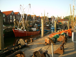
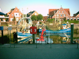
Der Hafen von Neuharlingersiel mit seinen Fischkuttern

Point of interest after 40.1 km

Point of interest after 40.1 km
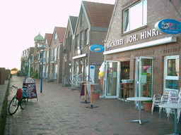
Hier gibts leckere Brötchen direkt an der Hafenmauer auf der Ostseite
Continue with Bikemap
Use, edit, or download this cycling route
You would like to ride Brötchen Tour or customize it for your own trip? Here is what you can do with this Bikemap route:
Free features
- Save this route as favorite or in collections
- Copy & plan your own version of this route
- Sync your route with Garmin or Wahoo
Premium features
Free trial for 3 days, or one-time payment. More about Bikemap Premium.
- Navigate this route on iOS & Android
- Export a GPX / KML file of this route
- Create your custom printout (try it for free)
- Download this route for offline navigation
Discover more Premium features.
Get Bikemap PremiumFrom our community
Other popular routes starting in Berumbur
 Berumbur Radfahren
- Distance
- 34.9 km
- Ascent
- 8 m
- Descent
- 8 m
- Location
- Berumbur, Lower Saxony, Germany
 Romme Tour 2015
- Distance
- 51.1 km
- Ascent
- 30 m
- Descent
- 29 m
- Location
- Berumbur, Lower Saxony, Germany
 Moorroute Ewiges Meer
- Distance
- 35.6 km
- Ascent
- 23 m
- Descent
- 24 m
- Location
- Berumbur, Lower Saxony, Germany
 Gemütliche Route in Norden
- Distance
- 9.5 km
- Ascent
- 0 m
- Descent
- 3 m
- Location
- Berumbur, Lower Saxony, Germany
 Radtour: 11 Siele - Jade - WHV - EJK - AUR
- Distance
- 164.9 km
- Ascent
- 28 m
- Descent
- 28 m
- Location
- Berumbur, Lower Saxony, Germany
 Berumbur-Lütetsburg-Berumbur
- Distance
- 12.7 km
- Ascent
- 450 m
- Descent
- 449 m
- Location
- Berumbur, Lower Saxony, Germany
 Brötchen Tour
- Distance
- 39.7 km
- Ascent
- 13 m
- Descent
- 12 m
- Location
- Berumbur, Lower Saxony, Germany
 Berumbur Aurich-Hafen
- Distance
- 21 km
- Ascent
- 10 m
- Descent
- 7 m
- Location
- Berumbur, Lower Saxony, Germany
Open it in the app


