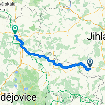
Cyklo popri rieke Dyje
A cycling route starting in Telč, Kraj Vysočina, Czechia.
Overview
About this route
In the first part, technical trails. Then wider roads.
- -:--
- Duration
- 226.1 km
- Distance
- 392 m
- Ascent
- 754 m
- Descent
- ---
- Avg. speed
- ---
- Max. altitude
Continue with Bikemap
Use, edit, or download this cycling route
You would like to ride Cyklo popri rieke Dyje or customize it for your own trip? Here is what you can do with this Bikemap route:
Free features
- Save this route as favorite or in collections
- Copy & plan your own version of this route
- Split it into stages to create a multi-day tour
- Sync your route with Garmin or Wahoo
Premium features
Free trial for 3 days, or one-time payment. More about Bikemap Premium.
- Navigate this route on iOS & Android
- Export a GPX / KML file of this route
- Create your custom printout (try it for free)
- Download this route for offline navigation
Discover more Premium features.
Get Bikemap PremiumFrom our community
Other popular routes starting in Telč
Cyklo popri rieke Dyje- Distance
- 226.1 km
- Ascent
- 392 m
- Descent
- 754 m
- Location
- Telč, Kraj Vysočina, Czechia
Tour de Mosty- Distance
- 23.8 km
- Ascent
- 386 m
- Descent
- 279 m
- Location
- Telč, Kraj Vysočina, Czechia
Vysočina- Distance
- 243.9 km
- Ascent
- 1,361 m
- Descent
- 1,364 m
- Location
- Telč, Kraj Vysočina, Czechia
okolo Telče- Distance
- 58.1 km
- Ascent
- 718 m
- Descent
- 721 m
- Location
- Telč, Kraj Vysočina, Czechia
ITT 16- Distance
- 15.9 km
- Ascent
- 176 m
- Descent
- 176 m
- Location
- Telč, Kraj Vysočina, Czechia
Trasa z Telč do Čestín- Distance
- 128.9 km
- Ascent
- 2,774 m
- Descent
- 2,792 m
- Location
- Telč, Kraj Vysočina, Czechia
Řásná-Telč-Javořice-Řásná- Distance
- 27.4 km
- Ascent
- 449 m
- Descent
- 449 m
- Location
- Telč, Kraj Vysočina, Czechia
Trasa z Pivovar Panský dvůr Telč do Čestín 29- Distance
- 92.5 km
- Ascent
- 1,606 m
- Descent
- 1,638 m
- Location
- Telč, Kraj Vysočina, Czechia
Open it in the app


