

Viaggiamondo Costa Rica
A cycling route starting in San José, Provincia de San José, Costa Rica.
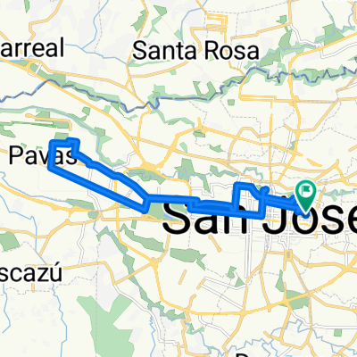
Overview
About this route
Accommodations: San José, Tortuguero, Puerto Viejo de Sarapiqui, La Fortuna de San Carlos, Monteverde, Samara Beach
Transfers: San José-Parque Tortuguero
Features: Easy itinerary: all transfers are done by private minibus and by boat, and the excursions do not present particular difficulties.
- -:--
- Duration
- 1,017.9 km
- Distance
- 3,931 m
- Ascent
- 3,959 m
- Descent
- ---
- Avg. speed
- ---
- Max. altitude

Route highlights
Points of interest along the route
Point of interest after 0.2 km
San José
Point of interest after 114.7 km
Parco Nazionale Tortoguero
Point of interest after 124.9 km
Tortuguero
Point of interest after 135 km
La Pavona
Point of interest after 230.9 km
Puerto Viejo de Sarapiqui
Point of interest after 329.9 km
La Fortuna
Point of interest after 415.7 km
Cano Negro Wildlife Refuge
Point of interest after 426.4 km
Lago Caño Negro
Point of interest after 431 km
Los Chiles
Point of interest after 544.6 km
Vulcano Arenal
Point of interest after 574.1 km
Lago Arenal
Point of interest after 642.3 km
Monteverde
Point of interest after 781.7 km
Playa Barrigona
Point of interest after 783.1 km
Samara Beach
Continue with Bikemap
Use, edit, or download this cycling route
You would like to ride Viaggiamondo Costa Rica or customize it for your own trip? Here is what you can do with this Bikemap route:
Free features
- Save this route as favorite or in collections
- Copy & plan your own version of this route
- Split it into stages to create a multi-day tour
- Sync your route with Garmin or Wahoo
Premium features
Free trial for 3 days, or one-time payment. More about Bikemap Premium.
- Navigate this route on iOS & Android
- Export a GPX / KML file of this route
- Create your custom printout (try it for free)
- Download this route for offline navigation
Discover more Premium features.
Get Bikemap PremiumFrom our community
Other popular routes starting in San José
 UNED, Barrio Escalante
- Distance
- 5.4 km
- Ascent
- 86 m
- Descent
- 31 m
- Location
- San José, Provincia de San José, Costa Rica
 Costa Rica
- Distance
- 180.2 km
- Ascent
- 1,770 m
- Descent
- 2,907 m
- Location
- San José, Provincia de San José, Costa Rica
 Viaggiamondo Costa Rica
- Distance
- 1,017.9 km
- Ascent
- 3,931 m
- Descent
- 3,959 m
- Location
- San José, Provincia de San José, Costa Rica
 San Jose - Cartago
- Distance
- 23.9 km
- Ascent
- 472 m
- Descent
- 192 m
- Location
- San José, Provincia de San José, Costa Rica
 Ruta de los Indios
- Distance
- 81 km
- Ascent
- 930 m
- Descent
- 1,852 m
- Location
- San José, Provincia de San José, Costa Rica
 Parque Nacional al Final del Boulevard Rohrmoser
- Distance
- 19.9 km
- Ascent
- 219 m
- Descent
- 219 m
- Location
- San José, Provincia de San José, Costa Rica
 MTB rough ride
- Distance
- 662.5 km
- Ascent
- 6,087 m
- Descent
- 6,079 m
- Location
- San José, Provincia de San José, Costa Rica
 zeppelin_viaggiamondo_costarica_2014
- Distance
- 614.5 km
- Ascent
- 5,332 m
- Descent
- 5,335 m
- Location
- San José, Provincia de San José, Costa Rica
Open it in the app