

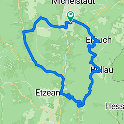
kleine hügelrunde um erbach
A cycling route starting in Erbach im Odenwald, Hesse, Germany.
Overview
About this route
von erbach auf der straße nach erbuch, nach bullau, dann asphaltierten weg nach gebhardtshütte, von dort den geschotterten/gewaltzen fahrradweg am krähberg vorbei zum reußenkreuz, auf der straße hinunter nach hetzbach, über die bundesstraße am marbach-see vorbei nach hüttental, dann über unter-mossau & tränkfeldeiche auf den straßen zurück nach erbach
(cloned from route 310078)
- -:--
- Duration
- 37.2 km
- Distance
- 697 m
- Ascent
- 689 m
- Descent
- ---
- Avg. speed
- ---
- Avg. speed
Route quality
Waytypes & surfaces along the route
Waytypes
Busy road
13.9 km
(37 %)
Road
12 km
(32 %)
Surfaces
Paved
27.2 km
(73 %)
Unpaved
4.2 km
(11 %)
Asphalt
27 km
(73 %)
Gravel
3.2 km
(9 %)
Continue with Bikemap
Use, edit, or download this cycling route
You would like to ride kleine hügelrunde um erbach or customize it for your own trip? Here is what you can do with this Bikemap route:
Free features
- Save this route as favorite or in collections
- Copy & plan your own version of this route
- Sync your route with Garmin or Wahoo
Premium features
Free trial for 3 days, or one-time payment. More about Bikemap Premium.
- Navigate this route on iOS & Android
- Export a GPX / KML file of this route
- Create your custom printout (try it for free)
- Download this route for offline navigation
Discover more Premium features.
Get Bikemap PremiumFrom our community
Other popular routes starting in Erbach im Odenwald
 Raubacher Runde
- Distance
- 60.4 km
- Ascent
- 970 m
- Descent
- 970 m
- Location
- Erbach im Odenwald, Hesse, Germany
 Odenwald 1
- Distance
- 41.8 km
- Ascent
- 673 m
- Descent
- 648 m
- Location
- Erbach im Odenwald, Hesse, Germany
 kleine hügelrunde um erbach
- Distance
- 37.2 km
- Ascent
- 874 m
- Descent
- 842 m
- Location
- Erbach im Odenwald, Hesse, Germany
 09.08
09.08- Distance
- 30 km
- Ascent
- 490 m
- Descent
- 488 m
- Location
- Erbach im Odenwald, Hesse, Germany
 Triple E
- Distance
- 83.8 km
- Ascent
- 516 m
- Descent
- 516 m
- Location
- Erbach im Odenwald, Hesse, Germany
 Schmuckertour
- Distance
- 53.3 km
- Ascent
- 730 m
- Descent
- 731 m
- Location
- Erbach im Odenwald, Hesse, Germany
 3-Länder-Radweg - Radfahren durch den Odenwald, an Main und Neckar - 3-Länder-Radweg - Radfahren durch den Odenwald, an Main und Neckar
- Distance
- 213.1 km
- Ascent
- 3,487 m
- Descent
- 3,487 m
- Location
- Erbach im Odenwald, Hesse, Germany
 RSG - Rund im Odenwald 2008
- Distance
- 113 km
- Ascent
- 2,007 m
- Descent
- 1,866 m
- Location
- Erbach im Odenwald, Hesse, Germany
Open it in the app