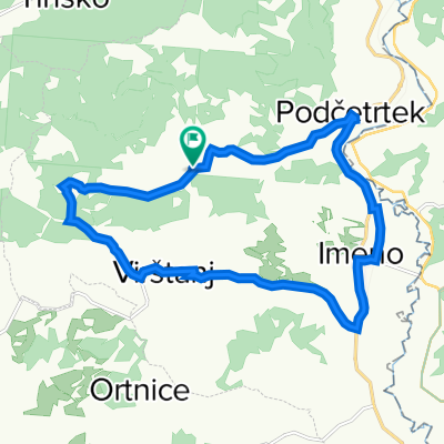
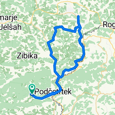
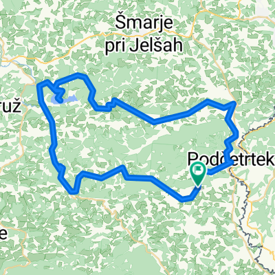
Sodna vas - Rogatec - Rogaška - Boč - Poljčane
A cycling route starting in Podčetrtek, Občina Podčetrtek, Slovenia.
Overview
About this route
- etapa čez Rogatec, Rogaško, Boč, Poljčane
- -:--
- Duration
- 23.1 km
- Distance
- 644 m
- Ascent
- 566 m
- Descent
- ---
- Avg. speed
- ---
- Avg. speed
Route quality
Waytypes & surfaces along the route
Waytypes
Quiet road
15.7 km
(68 %)
Road
4.1 km
(18 %)
Surfaces
Paved
13.5 km
(58 %)
Unpaved
0.1 km
(<1 %)
Asphalt
13.5 km
(58 %)
Unpaved (undefined)
0.1 km
(<1 %)
Undefined
9.5 km
(41 %)
Continue with Bikemap
Use, edit, or download this cycling route
You would like to ride Sodna vas - Rogatec - Rogaška - Boč - Poljčane or customize it for your own trip? Here is what you can do with this Bikemap route:
Free features
- Save this route as favorite or in collections
- Copy & plan your own version of this route
- Sync your route with Garmin or Wahoo
Premium features
Free trial for 3 days, or one-time payment. More about Bikemap Premium.
- Navigate this route on iOS & Android
- Export a GPX / KML file of this route
- Create your custom printout (try it for free)
- Download this route for offline navigation
Discover more Premium features.
Get Bikemap PremiumFrom our community
Other popular routes starting in Podčetrtek
- Cesta na grad 37, Podčetrtek to Olimje 90, Podčetrtek
- Distance
- 9.3 km
- Ascent
- 432 m
- Descent
- 476 m
- Location
- Podčetrtek, Občina Podčetrtek, Slovenia
- Renato olimlje - kozje olimje
- Distance
- 35.1 km
- Ascent
- 436 m
- Descent
- 555 m
- Location
- Podčetrtek, Občina Podčetrtek, Slovenia
- 2006 Akul SLO 4.dan (Podčetrtek - Laze pri Predgradu)
- Distance
- 172.2 km
- Ascent
- 1,536 m
- Descent
- 1,586 m
- Location
- Podčetrtek, Občina Podčetrtek, Slovenia
- Tour Slo 2023_1
- Distance
- 47.5 km
- Ascent
- 896 m
- Descent
- 853 m
- Location
- Podčetrtek, Občina Podčetrtek, Slovenia
- olimje
- Distance
- 60.5 km
- Ascent
- 2,767 m
- Descent
- 2,763 m
- Location
- Podčetrtek, Občina Podčetrtek, Slovenia
- Olimje blato tour
- Distance
- 63.2 km
- Ascent
- 400 m
- Descent
- 577 m
- Location
- Podčetrtek, Občina Podčetrtek, Slovenia
- Olimje - Žamerk - Grad Žusem - Babna gora - Orehovec - Zgornje Tinsko - Roginska Gorca - Sodna vas - Podčetrtek - Olimje
- Distance
- 35.4 km
- Ascent
- 696 m
- Descent
- 692 m
- Location
- Podčetrtek, Občina Podčetrtek, Slovenia
- Tour Slo 2023
- Distance
- 85.6 km
- Ascent
- 1,312 m
- Descent
- 1,347 m
- Location
- Podčetrtek, Občina Podčetrtek, Slovenia
Open it in the app