

Kamp-Lintfort-Kempen-Straelen-Kamp-Lintfort
A cycling route starting in Kamp-Lintfort, North Rhine-Westphalia, Germany.
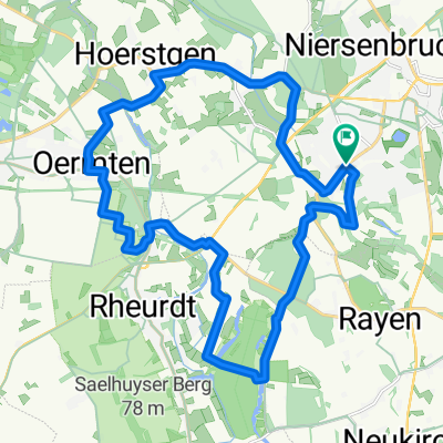
Overview
About this route
Diese Tour beginnt auf dem Prinzenplatz in Kamp-Lintfort entlang an den Littard Kuhlen zu dem einzigen anstrengenden Teil nordwestlich von Tönisberg über die Schaephysener Höhen nach Kempen, wo der Buttermarkt und das reizvolle Zentrum von Kempen zu einer Pause einladen.
Der Rückweg verläuft zwischen Herongen und Wankum nach Straelen. Auch hier animiert der Marktplatz mit den netten alten Häusern zu einer Pause. Von dort kann man vorbei an Nieukerk und über Sevelen wieder Kamp-Lintfort erreichen, ohne noch mal einen Höhenzug erklimmen zu müssen. Viel Vergnügen!! (cloned from route 257035)- -:--
- Duration
- 88.5 km
- Distance
- 100 m
- Ascent
- 100 m
- Descent
- ---
- Avg. speed
- ---
- Max. altitude
Route quality
Waytypes & surfaces along the route
Waytypes
Quiet road
41.1 km
(46 %)
Road
20.4 km
(23 %)
Surfaces
Paved
71.7 km
(81 %)
Unpaved
2.6 km
(3 %)
Asphalt
64.5 km
(73 %)
Paving stones
6.1 km
(7 %)
Route highlights
Points of interest along the route

Point of interest after 0.5 km
Stephanswäldchen mit Wandelweg

Point of interest after 0.7 km
Pappelsee

Point of interest after 5 km
Landgasthof zur Grenze

Point of interest after 8.3 km
Restaurant und Cafe Samannshof mit Biergarten

Point of interest after 8.3 km
Littard Kuhlen

Point of interest after 24.3 km
Kuhtor

Point of interest after 85.2 km
Kloster Kamp
Continue with Bikemap
Use, edit, or download this cycling route
You would like to ride Kamp-Lintfort-Kempen-Straelen-Kamp-Lintfort or customize it for your own trip? Here is what you can do with this Bikemap route:
Free features
- Save this route as favorite or in collections
- Copy & plan your own version of this route
- Split it into stages to create a multi-day tour
- Sync your route with Garmin or Wahoo
Premium features
Free trial for 3 days, or one-time payment. More about Bikemap Premium.
- Navigate this route on iOS & Android
- Export a GPX / KML file of this route
- Create your custom printout (try it for free)
- Download this route for offline navigation
Discover more Premium features.
Get Bikemap PremiumFrom our community
Other popular routes starting in Kamp-Lintfort
 Lintfort-Tour by O.Broll
- Distance
- 24.8 km
- Ascent
- 32 m
- Descent
- 27 m
- Location
- Kamp-Lintfort, North Rhine-Westphalia, Germany
 le tour de Kamp-Lintfort
- Distance
- 17.7 km
- Ascent
- 33 m
- Descent
- 27 m
- Location
- Kamp-Lintfort, North Rhine-Westphalia, Germany
 Drei Haldentour
- Distance
- 35.7 km
- Ascent
- 221 m
- Descent
- 223 m
- Location
- Kamp-Lintfort, North Rhine-Westphalia, Germany
 Frankys Runde, Pattberg, Homberg,Essenberg, Kaßlerfeld, Walsum, Orsoy, Budberg, Pattberg
- Distance
- 52.5 km
- Ascent
- 124 m
- Descent
- 122 m
- Location
- Kamp-Lintfort, North Rhine-Westphalia, Germany
 Lintfort - Oermter Berg - Lintfort
- Distance
- 23.3 km
- Ascent
- 86 m
- Descent
- 85 m
- Location
- Kamp-Lintfort, North Rhine-Westphalia, Germany
 Sakrale Bauten am Niederrhein
- Distance
- 63.5 km
- Ascent
- 124 m
- Descent
- 167 m
- Location
- Kamp-Lintfort, North Rhine-Westphalia, Germany
 Die Leucht-Route
- Distance
- 24.8 km
- Ascent
- 101 m
- Descent
- 103 m
- Location
- Kamp-Lintfort, North Rhine-Westphalia, Germany
 Kamp_Lintfort - Xanten um Nord und Südsee
- Distance
- 61.4 km
- Ascent
- 196 m
- Descent
- 196 m
- Location
- Kamp-Lintfort, North Rhine-Westphalia, Germany
Open it in the app