
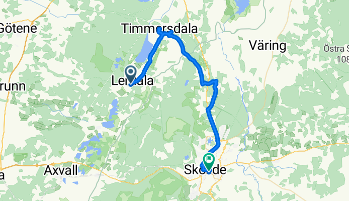
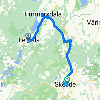
613_LERDALA-SKÖ
A cycling route starting in Stöpen, Västra Götaland County, Sweden.
Overview
About this route
613
- -:--
- Duration
- 31.2 km
- Distance
- 192 m
- Ascent
- 173 m
- Descent
- ---
- Avg. speed
- ---
- Max. altitude
Route quality
Waytypes & surfaces along the route
Waytypes
Road
20.6 km
(66 %)
Path
5.6 km
(18 %)
Surfaces
Paved
29.7 km
(95 %)
Paved (undefined)
15.9 km
(51 %)
Asphalt
13.7 km
(44 %)
Undefined
1.6 km
(5 %)
Route highlights
Points of interest along the route
Point of interest after 7.6 km
hållplats här
Point of interest after 20.1 km
Väg in
Continue with Bikemap
Use, edit, or download this cycling route
You would like to ride 613_LERDALA-SKÖ or customize it for your own trip? Here is what you can do with this Bikemap route:
Free features
- Save this route as favorite or in collections
- Copy & plan your own version of this route
- Sync your route with Garmin or Wahoo
Premium features
Free trial for 3 days, or one-time payment. More about Bikemap Premium.
- Navigate this route on iOS & Android
- Export a GPX / KML file of this route
- Create your custom printout (try it for free)
- Download this route for offline navigation
Discover more Premium features.
Get Bikemap PremiumFrom our community
Other popular routes starting in Stöpen
 Route to Bergslagsvägen, Askersund
- Distance
- 79.8 km
- Ascent
- 713 m
- Descent
- 705 m
- Location
- Stöpen, Västra Götaland County, Sweden
 From Mariestad to Väring
- Distance
- 48.5 km
- Ascent
- 273 m
- Descent
- 269 m
- Location
- Stöpen, Västra Götaland County, Sweden
 Länsväg O 2939, Väring to Länsväg O 2939, Tidan
- Distance
- 4.1 km
- Ascent
- 27 m
- Descent
- 22 m
- Location
- Stöpen, Västra Götaland County, Sweden
 Dag 4
Dag 4- Distance
- 91.9 km
- Ascent
- 240 m
- Descent
- 220 m
- Location
- Stöpen, Västra Götaland County, Sweden
 613_LERDALA-SKÖ
- Distance
- 31.2 km
- Ascent
- 192 m
- Descent
- 173 m
- Location
- Stöpen, Västra Götaland County, Sweden
 Fast ride in Mariestad
- Distance
- 35.2 km
- Ascent
- 222 m
- Descent
- 237 m
- Location
- Stöpen, Västra Götaland County, Sweden
 rundan
- Distance
- 25.8 km
- Ascent
- 165 m
- Descent
- 165 m
- Location
- Stöpen, Västra Götaland County, Sweden
 De Flistad à Väg utan namn
- Distance
- 37.5 km
- Ascent
- 296 m
- Descent
- 270 m
- Location
- Stöpen, Västra Götaland County, Sweden
Open it in the app