

Bike SA Outback Odyssey 2013 Day 2
A cycling route starting in Lobethal, South Australia, Australia.
Overview
About this route
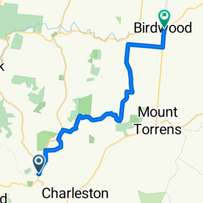
Lobethal to Tanunda - Chateau Tanunda
Route shown is a general guide - accuracy cannot be guaranteed. Subject to change depending on trail and weather conditions.
(cloned from route 886353)
- -:--
- Duration
- 74 km
- Distance
- 497 m
- Ascent
- 636 m
- Descent
- ---
- Avg. speed
- ---
- Avg. speed
Route quality
Waytypes & surfaces along the route
Waytypes
Quiet road
50.1 km
(68 %)
Track
12.8 km
(17 %)
Surfaces
Paved
14.8 km
(20 %)
Unpaved
43.3 km
(58 %)
Ground
28.2 km
(38 %)
Asphalt
14.6 km
(20 %)
Continue with Bikemap
Use, edit, or download this cycling route
You would like to ride Bike SA Outback Odyssey 2013 Day 2 or customize it for your own trip? Here is what you can do with this Bikemap route:
Free features
- Save this route as favorite or in collections
- Copy & plan your own version of this route
- Sync your route with Garmin or Wahoo
Premium features
Free trial for 3 days, or one-time payment. More about Bikemap Premium.
- Navigate this route on iOS & Android
- Export a GPX / KML file of this route
- Create your custom printout (try it for free)
- Download this route for offline navigation
Discover more Premium features.
Get Bikemap PremiumFrom our community
Other popular routes starting in Lobethal
 Adelaide
- Distance
- 45.1 km
- Ascent
- 342 m
- Descent
- 480 m
- Location
- Lobethal, South Australia, Australia
 Bike SA Outback Odyssey Day 2
- Distance
- 74 km
- Ascent
- 471 m
- Descent
- 610 m
- Location
- Lobethal, South Australia, Australia
 Lobethal Charleston , Mt Torrens All Sealed
- Distance
- 22.8 km
- Ascent
- 354 m
- Descent
- 354 m
- Location
- Lobethal, South Australia, Australia
 TDA - Charleston Ride (Palmer
- Distance
- 66.6 km
- Ascent
- 690 m
- Descent
- 616 m
- Location
- Lobethal, South Australia, Australia
 Jjjdfff
- Distance
- 18 km
- Ascent
- 119 m
- Descent
- 263 m
- Location
- Lobethal, South Australia, Australia
 Steep Track Reroute- Cudlee Creek
- Distance
- 0.9 km
- Ascent
- 106 m
- Descent
- 30 m
- Location
- Lobethal, South Australia, Australia
 Mawson Trail Lobethal to Birdwood
- Distance
- 18.4 km
- Ascent
- 204 m
- Descent
- 230 m
- Location
- Lobethal, South Australia, Australia
 EgoTrip 2009 V2
- Distance
- 32.9 km
- Ascent
- 790 m
- Descent
- 790 m
- Location
- Lobethal, South Australia, Australia
Open it in the app