

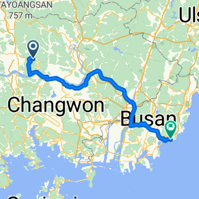
韓国縦走サイクリング2日目(陜川郡青徳面→亀尾)
A cycling route starting in Changnyeong, Gyeongsangnam-do, South Korea.
Overview
About this route
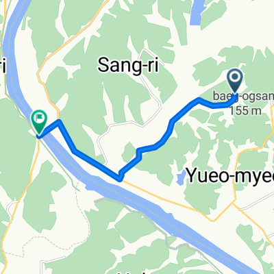
舗装状態はあまりよくないです。
大邱のセブンイレブンで 店員「韓国人じゃないでしょ?どこから来たの?」 私「日本です。」 店員「遠いとこから来ましたねー」 と韓国語で言われちゃいましたw- -:--
- Duration
- 124.5 km
- Distance
- 251 m
- Ascent
- 238 m
- Descent
- ---
- Avg. speed
- ---
- Max. altitude

Continue with Bikemap
Use, edit, or download this cycling route
You would like to ride 韓国縦走サイクリング2日目(陜川郡青徳面→亀尾) or customize it for your own trip? Here is what you can do with this Bikemap route:
Free features
- Save this route as favorite or in collections
- Copy & plan your own version of this route
- Split it into stages to create a multi-day tour
- Sync your route with Garmin or Wahoo
Premium features
Free trial for 3 days, or one-time payment. More about Bikemap Premium.
- Navigate this route on iOS & Android
- Export a GPX / KML file of this route
- Create your custom printout (try it for free)
- Download this route for offline navigation
Discover more Premium features.
Get Bikemap PremiumFrom our community
Other popular routes starting in Changnyeong
 Mook's house route
- Distance
- 7.4 km
- Ascent
- 76 m
- Descent
- 86 m
- Location
- Changnyeong, Gyeongsangnam-do, South Korea
 Day 11: Changnyeong - Busan
- Distance
- 114.4 km
- Ascent
- 156 m
- Descent
- 229 m
- Location
- Changnyeong, Gyeongsangnam-do, South Korea
 6 Changnyeong - Gijang
- Distance
- 102 km
- Ascent
- 823 m
- Descent
- 867 m
- Location
- Changnyeong, Gyeongsangnam-do, South Korea
 집에서 한실 삼거리로
- Distance
- 12.5 km
- Ascent
- 41 m
- Descent
- 84 m
- Location
- Changnyeong, Gyeongsangnam-do, South Korea
 韓国縦走サイクリング2日目(陜川郡青徳面→亀尾)
- Distance
- 124.5 km
- Ascent
- 251 m
- Descent
- 238 m
- Location
- Changnyeong, Gyeongsangnam-do, South Korea
 Nakseo-myeon 311-4, Euiryeong to Nakseo-myeon 1238-1, Euiryeong
- Distance
- 9 km
- Ascent
- 7 m
- Descent
- 8 m
- Location
- Changnyeong, Gyeongsangnam-do, South Korea
 남지읍 906-2, 창녕군 to 남지읍 11, 창녕군
- Distance
- 12.9 km
- Ascent
- 73 m
- Descent
- 77 m
- Location
- Changnyeong, Gyeongsangnam-do, South Korea
 Mook's house route
- Distance
- 7.3 km
- Ascent
- 159 m
- Descent
- 166 m
- Location
- Changnyeong, Gyeongsangnam-do, South Korea
Open it in the app