

Tour du col du granier
A cycling route starting in La Ravoire, Auvergne-Rhône-Alpes, France.
Overview
About this route
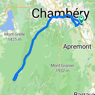
Tour du col du granier par saint jean de couz et saint pierre d'entremont
- -:--
- Duration
- 64.1 km
- Distance
- 1,234 m
- Ascent
- 1,232 m
- Descent
- ---
- Avg. speed
- ---
- Max. altitude

Route quality
Waytypes & surfaces along the route
Waytypes
Busy road
57.5 km
(90 %)
Road
4.5 km
(7 %)
Surfaces
Paved
58.3 km
(91 %)
Asphalt
58.3 km
(91 %)
Paving stones
0 km
(<1 %)
Undefined
5.8 km
(9 %)
Continue with Bikemap
Use, edit, or download this cycling route
You would like to ride Tour du col du granier or customize it for your own trip? Here is what you can do with this Bikemap route:
Free features
- Save this route as favorite or in collections
- Copy & plan your own version of this route
- Sync your route with Garmin or Wahoo
Premium features
Free trial for 3 days, or one-time payment. More about Bikemap Premium.
- Navigate this route on iOS & Android
- Export a GPX / KML file of this route
- Create your custom printout (try it for free)
- Download this route for offline navigation
Discover more Premium features.
Get Bikemap PremiumFrom our community
Other popular routes starting in La Ravoire
 lac saint andré
- Distance
- 19.7 km
- Ascent
- 218 m
- Descent
- 218 m
- Location
- La Ravoire, Auvergne-Rhône-Alpes, France
 Lar de saint andré/lac du bourget
- Distance
- 55 km
- Ascent
- 257 m
- Descent
- 253 m
- Location
- La Ravoire, Auvergne-Rhône-Alpes, France
 Tour du col du granier
- Distance
- 64.1 km
- Ascent
- 1,234 m
- Descent
- 1,232 m
- Location
- La Ravoire, Auvergne-Rhône-Alpes, France
 VTC - Balade du 31 juillet 2022
- Distance
- 76.3 km
- Ascent
- 1,640 m
- Descent
- 1,964 m
- Location
- La Ravoire, Auvergne-Rhône-Alpes, France
 Couz
Couz- Distance
- 42.6 km
- Ascent
- 448 m
- Descent
- 450 m
- Location
- La Ravoire, Auvergne-Rhône-Alpes, France
 De Rue de la Concorde, La Ravoire à Rue de la Concorde, La Ravoire
- Distance
- 14.3 km
- Ascent
- 87 m
- Descent
- 83 m
- Location
- La Ravoire, Auvergne-Rhône-Alpes, France
 saint pierre
- Distance
- 78.2 km
- Ascent
- 1,217 m
- Descent
- 1,217 m
- Location
- La Ravoire, Auvergne-Rhône-Alpes, France
 De Rue Louis Pasteur 380, La Ravoire à Rue de la Concorde 40, La Ravoire
- Distance
- 83.8 km
- Ascent
- 1,214 m
- Descent
- 1,230 m
- Location
- La Ravoire, Auvergne-Rhône-Alpes, France
Open it in the app