

Villnöß - Brogles - St. Ulrich
A cycling route starting in San Pietro, Trentino-Alto Adige, Italy.
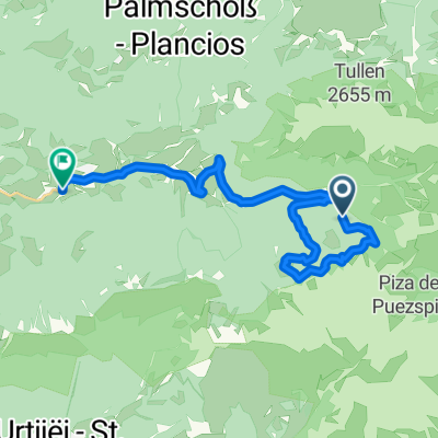
Overview
About this route
Departure from Brixen train station by bus on Sunday at 08:20 and arrival in Villnöß Ranui at around 09:00.
- -:--
- Duration
- 17.4 km
- Distance
- 922 m
- Ascent
- 969 m
- Descent
- ---
- Avg. speed
- ---
- Max. altitude

Route highlights
Points of interest along the route

Point of interest after 2.9 km
Aussicht auf Ploseberg

Photo after 3 km
Beginn der Schiebepassage

Point of interest after 3.1 km
...noch schieben..

Photo after 3.2 km
schoener Weg aber immer noch schieben

Photo after 4.1 km
Adolf Munkel weg gesperrt fue bikes

Point of interest after 4.6 km
Brogles Alm

Point of interest after 4.6 km
Brogles Alm Richtung Geisler

Point of interest after 5.1 km
oberhalb Brogles
Continue with Bikemap
Use, edit, or download this cycling route
You would like to ride Villnöß - Brogles - St. Ulrich or customize it for your own trip? Here is what you can do with this Bikemap route:
Free features
- Save this route as favorite or in collections
- Copy & plan your own version of this route
- Sync your route with Garmin or Wahoo
Premium features
Free trial for 3 days, or one-time payment. More about Bikemap Premium.
- Navigate this route on iOS & Android
- Export a GPX / KML file of this route
- Create your custom printout (try it for free)
- Download this route for offline navigation
Discover more Premium features.
Get Bikemap PremiumFrom our community
Other popular routes starting in San Pietro
 Brixen-Würzjoch-Geisleralm
- Distance
- 45.4 km
- Ascent
- 1,364 m
- Descent
- 2,787 m
- Location
- San Pietro, Trentino-Alto Adige, Italy
 Straße ohne Straßennamen, Villnöß nach Via Pizack 1, Funes
- Distance
- 19.5 km
- Ascent
- 347 m
- Descent
- 1,098 m
- Location
- San Pietro, Trentino-Alto Adige, Italy
 Rund um den Peitlerkofel von St. Magdalena aus
- Distance
- 35.4 km
- Ascent
- 1,342 m
- Descent
- 1,342 m
- Location
- San Pietro, Trentino-Alto Adige, Italy
 Transalp 2011 Tag 4
- Distance
- 42.5 km
- Ascent
- 2,130 m
- Descent
- 1,553 m
- Location
- San Pietro, Trentino-Alto Adige, Italy
 St Magdalena Runde
- Distance
- 51.5 km
- Ascent
- 1,489 m
- Descent
- 1,444 m
- Location
- San Pietro, Trentino-Alto Adige, Italy
 Villnöß - Zanser Grund - Geisleralm - Peitlerkofel - Umrundung - 40km - 1330 hm
- Distance
- 40.7 km
- Ascent
- 1,372 m
- Descent
- 1,371 m
- Location
- San Pietro, Trentino-Alto Adige, Italy
 Villnöß - Brogles - St. Ulrich
- Distance
- 17.4 km
- Ascent
- 922 m
- Descent
- 969 m
- Location
- San Pietro, Trentino-Alto Adige, Italy
 Rund um den Peitlerkofel von St. Magdalena aus
- Distance
- 35.4 km
- Ascent
- 1,385 m
- Descent
- 1,388 m
- Location
- San Pietro, Trentino-Alto Adige, Italy
Open it in the app