

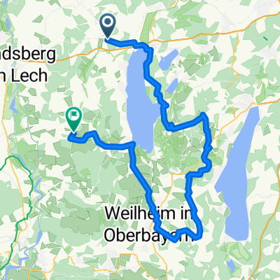
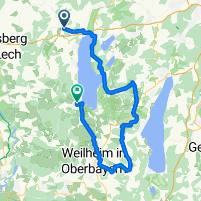
Greifenberg nach Tutzing
A cycling route starting in Greifenberg, Bavaria, Germany.
Overview
About this route
Route by the lakeside path and then along small and less trafficked roads to Tuzing
- -:--
- Duration
- 35.7 km
- Distance
- 273 m
- Ascent
- 177 m
- Descent
- ---
- Avg. speed
- 666 m
- Max. altitude
Route quality
Waytypes & surfaces along the route
Waytypes
Quiet road
11.1 km
(31 %)
Road
3.6 km
(10 %)
Surfaces
Paved
30.7 km
(86 %)
Unpaved
1.8 km
(5 %)
Asphalt
28.2 km
(79 %)
Paved (undefined)
2.5 km
(7 %)
Continue with Bikemap
Use, edit, or download this cycling route
You would like to ride Greifenberg nach Tutzing or customize it for your own trip? Here is what you can do with this Bikemap route:
Free features
- Save this route as favorite or in collections
- Copy & plan your own version of this route
- Sync your route with Garmin or Wahoo
Premium features
Free trial for 3 days, or one-time payment. More about Bikemap Premium.
- Navigate this route on iOS & Android
- Export a GPX / KML file of this route
- Create your custom printout (try it for free)
- Download this route for offline navigation
Discover more Premium features.
Get Bikemap PremiumFrom our community
Other popular routes starting in Greifenberg
 Greifenberg nach Tutzing
- Distance
- 35.7 km
- Ascent
- 273 m
- Descent
- 177 m
- Location
- Greifenberg, Bavaria, Germany
 give it a try
- Distance
- 28 km
- Ascent
- 140 m
- Descent
- 140 m
- Location
- Greifenberg, Bavaria, Germany
 Von Pflaumdorf bis Dießen am Ammersee
- Distance
- 91.3 km
- Ascent
- 969 m
- Descent
- 905 m
- Location
- Greifenberg, Bavaria, Germany
 Erster Versuch
- Distance
- 31.6 km
- Ascent
- 375 m
- Descent
- 372 m
- Location
- Greifenberg, Bavaria, Germany
 königsbrunn
- Distance
- 62 km
- Ascent
- 154 m
- Descent
- 154 m
- Location
- Greifenberg, Bavaria, Germany
 Von Eresing bis Dießen am Ammersee
- Distance
- 76.6 km
- Ascent
- 759 m
- Descent
- 782 m
- Location
- Greifenberg, Bavaria, Germany
 Greifenberg - Lechstaustufe
- Distance
- 60.3 km
- Ascent
- 374 m
- Descent
- 375 m
- Location
- Greifenberg, Bavaria, Germany
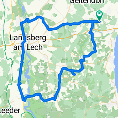 Pflaumdorf-Windach-Finning-Hofstetten-Thaining-Issing-Vilgertshofen-Stadl-Mundraching-Landsberg-Kaufering-Penzing-Pflaumdorf (keine ungeteerte Strecken)
- Distance
- 74.7 km
- Ascent
- 627 m
- Descent
- 682 m
- Location
- Greifenberg, Bavaria, Germany
Open it in the app