

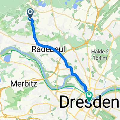
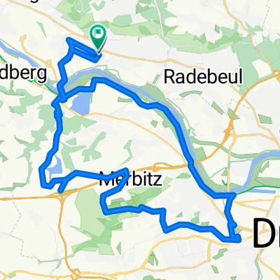
Briesnitz Dörfertour
A cycling route starting in Radebeul, Saxony, Germany.
Overview
About this route
This round tour is suitable for trained riders. The profile is very varied and on nice weather, it is a pleasant ride. Most of the time, riding is done on asphalt on relatively quiet roads.
- -:--
- Duration
- 58.8 km
- Distance
- 549 m
- Ascent
- 451 m
- Descent
- ---
- Avg. speed
- 304 m
- Max. altitude
Route quality
Waytypes & surfaces along the route
Waytypes
Road
15.9 km
(27 %)
Quiet road
13.5 km
(23 %)
Surfaces
Paved
44.7 km
(76 %)
Unpaved
1.8 km
(3 %)
Asphalt
44.7 km
(76 %)
Gravel
1.2 km
(2 %)
Continue with Bikemap
Use, edit, or download this cycling route
You would like to ride Briesnitz Dörfertour or customize it for your own trip? Here is what you can do with this Bikemap route:
Free features
- Save this route as favorite or in collections
- Copy & plan your own version of this route
- Sync your route with Garmin or Wahoo
Premium features
Free trial for 3 days, or one-time payment. More about Bikemap Premium.
- Navigate this route on iOS & Android
- Export a GPX / KML file of this route
- Create your custom printout (try it for free)
- Download this route for offline navigation
Discover more Premium features.
Get Bikemap PremiumFrom our community
Other popular routes starting in Radebeul
 Morgenleite nach Wilsdruffer Straße
- Distance
- 13.5 km
- Ascent
- 85 m
- Descent
- 220 m
- Location
- Radebeul, Saxony, Germany
 Schnelle Feierabend Runde
- Distance
- 46.1 km
- Ascent
- 305 m
- Descent
- 308 m
- Location
- Radebeul, Saxony, Germany
 20.07.25 Güterhofstraße, Radebeul nach Güterhofstraße, Radebeul
- Distance
- 34.2 km
- Ascent
- 342 m
- Descent
- 349 m
- Location
- Radebeul, Saxony, Germany
 Briesnitz Dörfertour
- Distance
- 58.8 km
- Ascent
- 549 m
- Descent
- 451 m
- Location
- Radebeul, Saxony, Germany
 Radebeul-Bärwalde-Volkersdorf-Radebeul
- Distance
- 35.3 km
- Ascent
- 188 m
- Descent
- 188 m
- Location
- Radebeul, Saxony, Germany
 Radebeul - Moritzburg
- Distance
- 35.5 km
- Ascent
- 247 m
- Descent
- 247 m
- Location
- Radebeul, Saxony, Germany
 Intervalltraining
- Distance
- 24.9 km
- Ascent
- 257 m
- Descent
- 208 m
- Location
- Radebeul, Saxony, Germany
 Linkselbische Täler
- Distance
- 32.2 km
- Ascent
- 633 m
- Descent
- 659 m
- Location
- Radebeul, Saxony, Germany
Open it in the app