

hare_test
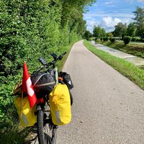
A cycling route starting in Siegsdorf, Bavaria, Germany.
Overview
About this route
- -:--
- Duration
- 135.6 km
- Distance
- 3,408 m
- Ascent
- 3,505 m
- Descent
- ---
- Avg. speed
- 1,551 m
- Max. altitude
Route quality
Waytypes & surfaces along the route
Waytypes
Road
28.5 km
(21 %)
Path
13.6 km
(10 %)
Surfaces
Paved
113.9 km
(84 %)
Unpaved
10.8 km
(8 %)
Asphalt
113.9 km
(84 %)
Gravel
8.1 km
(6 %)
Continue with Bikemap
Use, edit, or download this cycling route
You would like to ride hare_test or customize it for your own trip? Here is what you can do with this Bikemap route:
Free features
- Save this route as favorite or in collections
- Copy & plan your own version of this route
- Split it into stages to create a multi-day tour
- Sync your route with Garmin or Wahoo
Premium features
Free trial for 3 days, or one-time payment. More about Bikemap Premium.
- Navigate this route on iOS & Android
- Export a GPX / KML file of this route
- Create your custom printout (try it for free)
- Download this route for offline navigation
Discover more Premium features.
Get Bikemap PremiumFrom our community
Other popular routes starting in Siegsdorf
 hare_test
- Distance
- 135.6 km
- Ascent
- 3,408 m
- Descent
- 3,505 m
- Location
- Siegsdorf, Bavaria, Germany
 Bäcker Alm, Inzell, Ruhpolding.gpx
- Distance
- 46.9 km
- Ascent
- 872 m
- Descent
- 872 m
- Location
- Siegsdorf, Bavaria, Germany
 Zinnkopf Runde
- Distance
- 19 km
- Ascent
- 568 m
- Descent
- 576 m
- Location
- Siegsdorf, Bavaria, Germany
 Sonnenstraße, Siegsdorf nach Nonn, Bad Reichenhall
- Distance
- 34.7 km
- Ascent
- 356 m
- Descent
- 495 m
- Location
- Siegsdorf, Bavaria, Germany
 Tag 1
Tag 1- Distance
- 69.1 km
- Ascent
- 986 m
- Descent
- 857 m
- Location
- Siegsdorf, Bavaria, Germany
 Siegsdorf - Inzell - Ruhpolding - Siegsdorf
- Distance
- 32.3 km
- Ascent
- 277 m
- Descent
- 277 m
- Location
- Siegsdorf, Bavaria, Germany
 Voraf - Siegsdorf -Traunstein Knappenfeld
- Distance
- 24.2 km
- Ascent
- 242 m
- Descent
- 282 m
- Location
- Siegsdorf, Bavaria, Germany
 5. Siegsdorf-Bad Feilnbach-72km-800Hm
- Distance
- 74.3 km
- Ascent
- 708 m
- Descent
- 828 m
- Location
- Siegsdorf, Bavaria, Germany
Open it in the app