Oberlausitzer Bergland
A cycling route starting in Radibor, Saxony, Germany.
Overview
About this route
SCHÖÖNE Tour mt einem Hammer Anstieg
- -:--
- Duration
- 45.1 km
- Distance
- 466 m
- Ascent
- 449 m
- Descent
- ---
- Avg. speed
- 398 m
- Max. altitude
Route quality
Waytypes & surfaces along the route
Waytypes
Road
22.2 km
(49 %)
Busy road
11 km
(24 %)
Surfaces
Paved
40.9 km
(91 %)
Unpaved
0.2 km
(<1 %)
Asphalt
40.9 km
(91 %)
Ground
0.2 km
(<1 %)
Undefined
3.9 km
(9 %)
Continue with Bikemap
Use, edit, or download this cycling route
You would like to ride Oberlausitzer Bergland or customize it for your own trip? Here is what you can do with this Bikemap route:
Free features
- Save this route as favorite or in collections
- Copy & plan your own version of this route
- Sync your route with Garmin or Wahoo
Premium features
Free trial for 3 days, or one-time payment. More about Bikemap Premium.
- Navigate this route on iOS & Android
- Export a GPX / KML file of this route
- Create your custom printout (try it for free)
- Download this route for offline navigation
Discover more Premium features.
Get Bikemap PremiumFrom our community
Other popular routes starting in Radibor
- Abfischen am Inselteich Radibor
- Distance
- 25.3 km
- Ascent
- 170 m
- Descent
- 170 m
- Location
- Radibor, Saxony, Germany
- Oberlausitzer Bergland
- Distance
- 45.1 km
- Ascent
- 466 m
- Descent
- 449 m
- Location
- Radibor, Saxony, Germany
- Von Bautzen nach Görlitz
- Distance
- 56.3 km
- Ascent
- 403 m
- Descent
- 416 m
- Location
- Radibor, Saxony, Germany
- ALTE BAHNTRASSE
- Distance
- 57.7 km
- Ascent
- 401 m
- Descent
- 401 m
- Location
- Radibor, Saxony, Germany
- Lausitzer Heide- und Teichland
- Distance
- 50.6 km
- Ascent
- 89 m
- Descent
- 92 m
- Location
- Radibor, Saxony, Germany
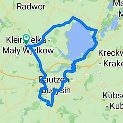
- Fahrradtour rund um Bautzen
- Distance
- 27.7 km
- Ascent
- 197 m
- Descent
- 194 m
- Location
- Radibor, Saxony, Germany
- Neschwitz-Hahneberg
- Distance
- 47.3 km
- Ascent
- 0 m
- Descent
- 0 m
- Location
- Radibor, Saxony, Germany
- eben mal sonnabend
- Distance
- 76 km
- Ascent
- 516 m
- Descent
- 508 m
- Location
- Radibor, Saxony, Germany
Open it in the app