

Travesía Cotopaxi - Mulaló
A cycling route starting in Machachi, Pichincha, Ecuador.
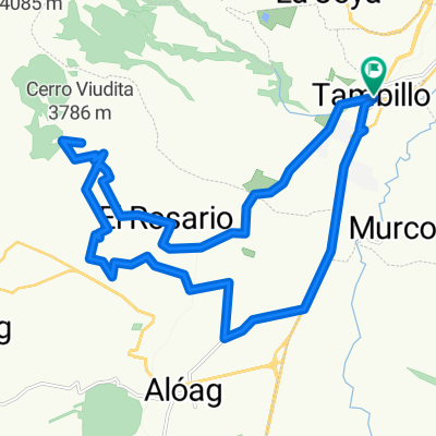
Overview
About this route
Cotopaxi-Mulaló Crossing
- -:--
- Duration
- 53.8 km
- Distance
- 490 m
- Ascent
- 946 m
- Descent
- ---
- Avg. speed
- ---
- Max. altitude

Route quality
Waytypes & surfaces along the route
Waytypes
Quiet road
30.1 km
(56 %)
Road
16.7 km
(31 %)
Surfaces
Paved
8.6 km
(16 %)
Unpaved
19.9 km
(37 %)
Ground
11.8 km
(22 %)
Asphalt
8.6 km
(16 %)
Route highlights
Points of interest along the route
Point of interest after 0 km
Santa Ana del Pedregal (la Y) - Punto de encuentro 7:30 am
Point of interest after 6 km
Control Norte Parque Nacional Cotopaxi
Point of interest after 8.7 km
Hostería Tambopaxi
Point of interest after 14 km
Laguna Limpiopungo
Point of interest after 33.2 km
Desvío a Mulaló sector Santa Rita
Point of interest after 33.2 km
Entra Sur Parque Nacional Cotopaxi
Point of interest after 42.2 km
Mulaló
Point of interest after 53.8 km
Entrada a Pastocalle - camionetas de alquiler
Continue with Bikemap
Use, edit, or download this cycling route
You would like to ride Travesía Cotopaxi - Mulaló or customize it for your own trip? Here is what you can do with this Bikemap route:
Free features
- Save this route as favorite or in collections
- Copy & plan your own version of this route
- Sync your route with Garmin or Wahoo
Premium features
Free trial for 3 days, or one-time payment. More about Bikemap Premium.
- Navigate this route on iOS & Android
- Export a GPX / KML file of this route
- Create your custom printout (try it for free)
- Download this route for offline navigation
Discover more Premium features.
Get Bikemap PremiumFrom our community
Other popular routes starting in Machachi
 bike tour through Mejia
- Distance
- 29 km
- Ascent
- 331 m
- Descent
- 573 m
- Location
- Machachi, Pichincha, Ecuador
 Tour Montaña Nestlé Papagayo 80k
- Distance
- 75.5 km
- Ascent
- 1,298 m
- Descent
- 1,298 m
- Location
- Machachi, Pichincha, Ecuador
 PISTA PEQUEÑA - COPA NECU 2da VALIDA
- Distance
- 0.7 km
- Ascent
- 29 m
- Descent
- 30 m
- Location
- Machachi, Pichincha, Ecuador
 MTB - Ilinizas
- Distance
- 41.3 km
- Ascent
- 586 m
- Descent
- 722 m
- Location
- Machachi, Pichincha, Ecuador
 MTB Antenas de la Viudita
- Distance
- 33.1 km
- Ascent
- 1,093 m
- Descent
- 1,094 m
- Location
- Machachi, Pichincha, Ecuador
 MTB Antenas de la Viudita
- Distance
- 33.1 km
- Ascent
- 1,093 m
- Descent
- 1,094 m
- Location
- Machachi, Pichincha, Ecuador
 Tour Montaña Nestlé Papagayo 40k CLONED FROM ROUTE 1759217
- Distance
- 41.1 km
- Ascent
- 903 m
- Descent
- 903 m
- Location
- Machachi, Pichincha, Ecuador
 De Carretera Panamericana, Machachi a Troncal de la Sierra
- Distance
- 14.7 km
- Ascent
- 538 m
- Descent
- 37 m
- Location
- Machachi, Pichincha, Ecuador
Open it in the app