

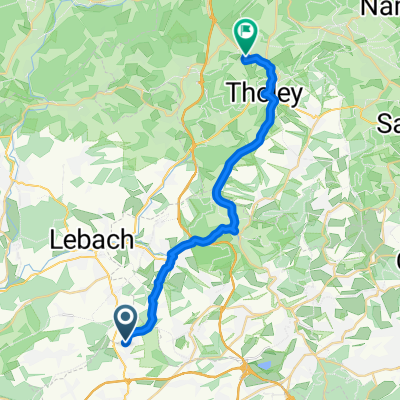
Lebach-Hoxberg-Saarwellingen-Quierschied-Mapingen-Lebach
A cycling route starting in Heusweiler, Saarland, Germany.
Overview
About this route
Lebach-Hoxberg-Saarwellingen-Quierschied-Mapingen-Lebach (changed from a GPS route by @Stefan :) )
- -:--
- Duration
- 75.8 km
- Distance
- 842 m
- Ascent
- 842 m
- Descent
- ---
- Avg. speed
- ---
- Max. altitude
Route quality
Waytypes & surfaces along the route
Waytypes
Road
16.7 km
(22 %)
Track
8.3 km
(11 %)
Surfaces
Paved
63.6 km
(84 %)
Unpaved
1.5 km
(2 %)
Asphalt
55.3 km
(73 %)
Paved (undefined)
7.6 km
(10 %)
Continue with Bikemap
Use, edit, or download this cycling route
You would like to ride Lebach-Hoxberg-Saarwellingen-Quierschied-Mapingen-Lebach or customize it for your own trip? Here is what you can do with this Bikemap route:
Free features
- Save this route as favorite or in collections
- Copy & plan your own version of this route
- Sync your route with Garmin or Wahoo
Premium features
Free trial for 3 days, or one-time payment. More about Bikemap Premium.
- Navigate this route on iOS & Android
- Export a GPX / KML file of this route
- Create your custom printout (try it for free)
- Download this route for offline navigation
Discover more Premium features.
Get Bikemap PremiumFrom our community
Other popular routes starting in Heusweiler
 Hoxberg-Litermont Gipfeltour
- Distance
- 18.2 km
- Ascent
- 494 m
- Descent
- 322 m
- Location
- Heusweiler, Saarland, Germany
 Eiweiler-Dirmingen-Theley
- Distance
- 22.4 km
- Ascent
- 353 m
- Descent
- 239 m
- Location
- Heusweiler, Saarland, Germany
 Sprenger Wald-VK-H
- Distance
- 27.2 km
- Ascent
- 210 m
- Descent
- 210 m
- Location
- Heusweiler, Saarland, Germany
 Wanderung Heusweiler
- Distance
- 9.8 km
- Ascent
- 171 m
- Descent
- 170 m
- Location
- Heusweiler, Saarland, Germany
 Hoxberg-Prims-Saarwellingen-Runde
- Distance
- 19.2 km
- Ascent
- 351 m
- Descent
- 327 m
- Location
- Heusweiler, Saarland, Germany
 T1-saarlouis-völkingen-heusweiler
- Distance
- 52.2 km
- Ascent
- 207 m
- Descent
- 207 m
- Location
- Heusweiler, Saarland, Germany
 Lebach-Hoxberg-Saarwellingen-Quierschied-Mapingen-Lebach
- Distance
- 75.8 km
- Ascent
- 842 m
- Descent
- 842 m
- Location
- Heusweiler, Saarland, Germany
 NiSa-Wadga-SB-NiSa
- Distance
- 49 km
- Ascent
- 354 m
- Descent
- 357 m
- Location
- Heusweiler, Saarland, Germany
Open it in the app