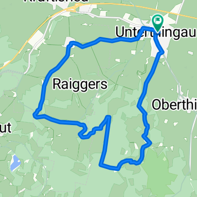
Nördlich von Unterthingau
A cycling route starting in Unterthingau, Bavaria, Germany.
Overview
About this route
Einfache Mountenbiketour auf Schotter
- -:--
- Duration
- 49.9 km
- Distance
- 417 m
- Ascent
- 417 m
- Descent
- ---
- Avg. speed
- ---
- Max. altitude
Route quality
Waytypes & surfaces along the route
Waytypes
Track
34 km
(68 %)
Quiet road
10.4 km
(21 %)
Surfaces
Paved
7.5 km
(15 %)
Unpaved
33 km
(66 %)
Gravel
18.8 km
(38 %)
Unpaved (undefined)
10.6 km
(21 %)
Continue with Bikemap
Use, edit, or download this cycling route
You would like to ride Nördlich von Unterthingau or customize it for your own trip? Here is what you can do with this Bikemap route:
Free features
- Save this route as favorite or in collections
- Copy & plan your own version of this route
- Sync your route with Garmin or Wahoo
Premium features
Free trial for 3 days, or one-time payment. More about Bikemap Premium.
- Navigate this route on iOS & Android
- Export a GPX / KML file of this route
- Create your custom printout (try it for free)
- Download this route for offline navigation
Discover more Premium features.
Get Bikemap PremiumFrom our community
Other popular routes starting in Unterthingau
- Utg Füssen Utg 4.6.11
- Distance
- 78 km
- Ascent
- 306 m
- Descent
- 306 m
- Location
- Unterthingau, Bavaria, Germany
- Kleine Abendrunde Utg 11
- Distance
- 23.5 km
- Ascent
- 334 m
- Descent
- 334 m
- Location
- Unterthingau, Bavaria, Germany
- Kleine Abendrunde Utg 06
- Distance
- 29.8 km
- Ascent
- 226 m
- Descent
- 228 m
- Location
- Unterthingau, Bavaria, Germany
- Knollenhaag lange Runde
- Distance
- 24.6 km
- Ascent
- 329 m
- Descent
- 329 m
- Location
- Unterthingau, Bavaria, Germany
- Am Obstgarten 1, Unterthingau nach Am Obstgarten 1A, Unterthingau
- Distance
- 59.4 km
- Ascent
- 261 m
- Descent
- 262 m
- Location
- Unterthingau, Bavaria, Germany
- Kleine Abendrunde Utg 15
- Distance
- 27.1 km
- Ascent
- 223 m
- Descent
- 223 m
- Location
- Unterthingau, Bavaria, Germany
- Bergmang Alpe
- Distance
- 27.7 km
- Ascent
- 244 m
- Descent
- 245 m
- Location
- Unterthingau, Bavaria, Germany
- Utg - OStB Tag 1
- Distance
- 41.7 km
- Ascent
- 396 m
- Descent
- 307 m
- Location
- Unterthingau, Bavaria, Germany
Open it in the app