

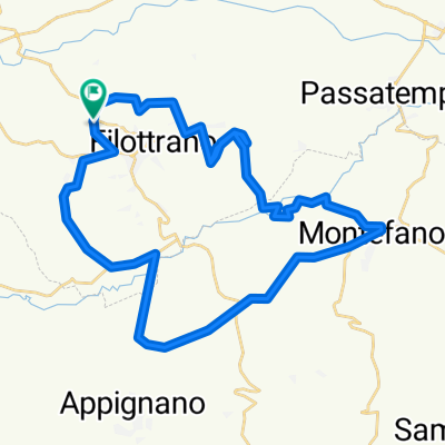
Filottrano - Roccaccia S.Lorenzo di Treia e ritorno
A cycling route starting in Filottrano, The Marches, Italy.
Overview
About this route
percorso in maggior parte su strade asfaltate e imbrecciate, non trafficate, e brevi tratti di sentieri dal torrente rio fino alla strada bar san lorenzo.
andata e ritorno dal bar fino alla rocaccia salita asfaltata con belle pendenze e tornati lunghezza circa 7-8 km ritorno stesso itinerario con tratti di sentiero roccioso e variante per la pavanella
- -:--
- Duration
- 50.8 km
- Distance
- 1,215 m
- Ascent
- 1,239 m
- Descent
- ---
- Avg. speed
- 789 m
- Max. altitude

Route quality
Waytypes & surfaces along the route
Waytypes
Quiet road
13.6 km
(27 %)
Road
13.2 km
(26 %)
Surfaces
Paved
2.5 km
(5 %)
Unpaved
9.8 km
(19 %)
Gravel
9 km
(18 %)
Asphalt
2.5 km
(5 %)
Continue with Bikemap
Use, edit, or download this cycling route
You would like to ride Filottrano - Roccaccia S.Lorenzo di Treia e ritorno or customize it for your own trip? Here is what you can do with this Bikemap route:
Free features
- Save this route as favorite or in collections
- Copy & plan your own version of this route
- Sync your route with Garmin or Wahoo
Premium features
Free trial for 3 days, or one-time payment. More about Bikemap Premium.
- Navigate this route on iOS & Android
- Export a GPX / KML file of this route
- Create your custom printout (try it for free)
- Download this route for offline navigation
Discover more Premium features.
Get Bikemap PremiumFrom our community
Other popular routes starting in Filottrano
 Recovered Route 21-mar
- Distance
- 49.8 km
- Ascent
- 752 m
- Descent
- 754 m
- Location
- Filottrano, The Marches, Italy
 Filottrano Colline MTB
- Distance
- 31 km
- Ascent
- 451 m
- Descent
- 451 m
- Location
- Filottrano, The Marches, Italy
 Filottrano - Roccaccia S.Lorenzo di Treia e ritorno
- Distance
- 50.8 km
- Ascent
- 1,215 m
- Descent
- 1,239 m
- Location
- Filottrano, The Marches, Italy
 magnabike2013c
- Distance
- 12.7 km
- Ascent
- 198 m
- Descent
- 197 m
- Location
- Filottrano, The Marches, Italy
 TRA MARE E MONTI
- Distance
- 50.9 km
- Ascent
- 774 m
- Descent
- 792 m
- Location
- Filottrano, The Marches, Italy
 GARA MTB FILOTTRANO
- Distance
- 15.5 km
- Ascent
- 502 m
- Descent
- 501 m
- Location
- Filottrano, The Marches, Italy
 Anello
- Distance
- 64.2 km
- Ascent
- 829 m
- Descent
- 842 m
- Location
- Filottrano, The Marches, Italy
 LUNGO IL FIUME MUSONE
- Distance
- 54.6 km
- Ascent
- 315 m
- Descent
- 315 m
- Location
- Filottrano, The Marches, Italy
Open it in the app