

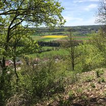
Trainingsrunde durch Wald und Wiesen
A cycling route starting in Forchtenberg, Baden-Wurttemberg, Germany.
Overview
About this route
Anfangs noch sehr gemütlich, vorsicht bei der Abfahrt am Grund sehr kurvig und steil! Wenn die Sonne runterknallt sind die Bergauffahrten richtig zum schwitzen!
(cloned from route 562465)- -:--
- Duration
- 34.5 km
- Distance
- 595 m
- Ascent
- 595 m
- Descent
- ---
- Avg. speed
- ---
- Max. altitude

Continue with Bikemap
Use, edit, or download this cycling route
You would like to ride Trainingsrunde durch Wald und Wiesen or customize it for your own trip? Here is what you can do with this Bikemap route:
Free features
- Save this route as favorite or in collections
- Copy & plan your own version of this route
- Sync your route with Garmin or Wahoo
Premium features
Free trial for 3 days, or one-time payment. More about Bikemap Premium.
- Navigate this route on iOS & Android
- Export a GPX / KML file of this route
- Create your custom printout (try it for free)
- Download this route for offline navigation
Discover more Premium features.
Get Bikemap PremiumFrom our community
Other popular routes starting in Forchtenberg
 Trainingsrunde durch Wald und Wiesen
- Distance
- 34.5 km
- Ascent
- 595 m
- Descent
- 595 m
- Location
- Forchtenberg, Baden-Wurttemberg, Germany
 Recovered Route
- Distance
- 18 km
- Ascent
- 25 m
- Descent
- 27 m
- Location
- Forchtenberg, Baden-Wurttemberg, Germany
 Trainingsrunde Kochertalexpress
- Distance
- 39.9 km
- Ascent
- 522 m
- Descent
- 522 m
- Location
- Forchtenberg, Baden-Wurttemberg, Germany
 Forchtenberg- Jagst-Kocher Radweg
- Distance
- 79.4 km
- Ascent
- 393 m
- Descent
- 408 m
- Location
- Forchtenberg, Baden-Wurttemberg, Germany
 Von Ernsbach über Westernhausen Richtung Bieringen und vom Kloster Schöntal zurück
- Distance
- 37.4 km
- Ascent
- 621 m
- Descent
- 617 m
- Location
- Forchtenberg, Baden-Wurttemberg, Germany
 Samstag Durchdrehrunde mir einigen HM
- Distance
- 77.4 km
- Ascent
- 1,715 m
- Descent
- 1,693 m
- Location
- Forchtenberg, Baden-Wurttemberg, Germany
 Rund um Forchtenberg, Weissbach, Niedernhall
- Distance
- 33.7 km
- Ascent
- 654 m
- Descent
- 654 m
- Location
- Forchtenberg, Baden-Wurttemberg, Germany
 Kocher-Jagst3, Forcht-berg-Bad Friedr.hall
- Distance
- 37.7 km
- Ascent
- 84 m
- Descent
- 120 m
- Location
- Forchtenberg, Baden-Wurttemberg, Germany
Open it in the app