

BiciBus OraCletos
A cycling route starting in Guadalajara, Jalisco, Mexico.
Overview
About this route
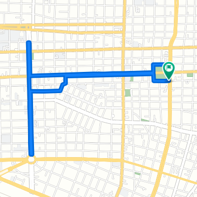
Ruta # 1 del BiciBus de los OraCletos
- -:--
- Duration
- 12.4 km
- Distance
- 103 m
- Ascent
- 84 m
- Descent
- ---
- Avg. speed
- ---
- Max. altitude

Route highlights
Points of interest along the route
Point of interest after 1.6 km
Punto de encuentro #1
Point of interest after 5.7 km
Punto de encuentro #2
Point of interest after 9.2 km
Punto de encuentro #3
Continue with Bikemap
Use, edit, or download this cycling route
You would like to ride BiciBus OraCletos or customize it for your own trip? Here is what you can do with this Bikemap route:
Free features
- Save this route as favorite or in collections
- Copy & plan your own version of this route
- Sync your route with Garmin or Wahoo
Premium features
Free trial for 3 days, or one-time payment. More about Bikemap Premium.
- Navigate this route on iOS & Android
- Export a GPX / KML file of this route
- Create your custom printout (try it for free)
- Download this route for offline navigation
Discover more Premium features.
Get Bikemap PremiumFrom our community
Other popular routes starting in Guadalajara
 Avenida Ludwig Van Beethoven 5800, Zapopan to Avenida Ludwig Van Beethoven 5800, Zapopan
- Distance
- 11.6 km
- Ascent
- 34 m
- Descent
- 34 m
- Location
- Guadalajara, Jalisco, Mexico
 De Avenida República 145, Guadalajara a Prosperidad 9, Guadalajara
- Distance
- 22.8 km
- Ascent
- 124 m
- Descent
- 127 m
- Location
- Guadalajara, Jalisco, Mexico
 De Uruguay 2406, Guadalajara a Uruguay 2401, Guadalajara
- Distance
- 49.1 km
- Ascent
- 560 m
- Descent
- 548 m
- Location
- Guadalajara, Jalisco, Mexico
 Rojo-Chapu
- Distance
- 5.5 km
- Ascent
- 75 m
- Descent
- 74 m
- Location
- Guadalajara, Jalisco, Mexico
 BiciBus OraCletos
- Distance
- 12.4 km
- Ascent
- 103 m
- Descent
- 84 m
- Location
- Guadalajara, Jalisco, Mexico
 naranjas en fracc revoluciom
- Distance
- 21 km
- Ascent
- 199 m
- Descent
- 197 m
- Location
- Guadalajara, Jalisco, Mexico
 guadalajara manzanillo
- Distance
- 363.6 km
- Ascent
- 809 m
- Descent
- 2,342 m
- Location
- Guadalajara, Jalisco, Mexico
 Calle Moscú 30, Guadalajara a Calle Fray Luis de Palacios 2472, Guadalajara
- Distance
- 2.4 km
- Ascent
- 20 m
- Descent
- 0 m
- Location
- Guadalajara, Jalisco, Mexico
Open it in the app